
24x7 Support
+977 9851349597
Unbeatable Holiday Offers - Save Up to 20% on Your Next Adventure!

Trek to Manaslu Base Camp, visit Pungyen Gompa, hike to the Tibet border, and cross Larkya La - All in one Manaslu Circuit Journey!
Manaslu Base Camp Larke Pass Trek – 15 Days
Based on 60 reviews
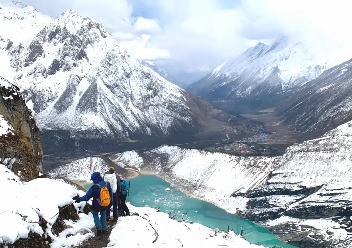
The 15-Day Manaslu Base Camp Larke Pass Trek takes you deep into the Manaslu region of Nepal, combining the classic Manaslu Circuit Trek with a visit to the majestic Manaslu Base Camp (4,800 m). Along the way, you will pass through remote local villages, visit the historic Pungyen Gompa, take a side trip toward the Tibet border from Samdo, and cross the high Himalayan pass of Larkya La (5,106 m).
The route follows the Budhi Gandaki valley in the lower region, then continues through Tsum and Nubri in the middle and upper areas, offering a well-balanced itinerary through the heart of the Manaslu region. Along the trail, you will enjoy stunning mountain views, including majestic Mount Manaslu (8,163 m), experience Tibetan-influenced local culture, and walk one of the most scenic off-the-beaten-path trails in central-west Nepal.
This is a physically demanding trek, with long walking days and high-altitude terrain, making it best suited for trekkers with some prior hiking experience who are ready for a moderate-to-difficult Himalayan adventure in Nepal. Since Manaslu is a restricted region of Nepal, trekkers must obtain a Restricted Area Permit (RAP) and trek with a licensed guide

Duration
15 Days
Trip Difficulty
Difficult
Max Altitude:
5,106m. / 16,752ft.
Activity
Trekking
Group Size
1-15
Best Season
Autumn | Spring
Meals
Breakfast, Lunch & Dinner
Accommodation
Hotel | Guesthouse
Transportation
Private VehicleOverview of Manaslu Base Camp Larke Pass Trek – 15 Days
The 15-Day Manaslu Base Camp Larke Pass Trek is a carefully paced Himalayan adventure that takes place in the Manaslu region of Nepal. It combines demanding high-altitude walking with remote mountain scenery, Buddhist culture, and thrilling mountain pass crossing. You could stand beneath Mount Manaslu (8,163 m), cross a 5,106 meters Himalayan pass, and experience Tibetan-influenced villages all in 15 days.
The trek circles the Earth’s 8th-highest peak (Manaslu), similar as the Manaslu circuit trek and takes you to its majestic base at 4,800 meters. You will walk roughly 150-177 km. starting in subtropical farmland around 869 meters, the trail reaches above 5,000 meters at Larke La Pass.
Being a restricted zone, Manaslu trek route requires a special Restricted Area Permit (RAP) and a licensed guide. It means you can’t trek independently in the region of Manaslu. That restriction is exactly why the trail is quiet, teahouses are simple, and the local culture is less affected by mass tourism. For trekkers, it creates a more remote and less commercial Himalayan experience with the raw beauty of the Manaslu circuit region.
While it is not a mountaineering adventure, the trek is quite physically strenuous owing to the long trekking days, rough terrain and high altitude. It is a great option for well-prepared trekkers looking for an adventurous Himalayan experience on the less touristic trail. Via off the beaten paths, you will explore the isolated wilderness of the Manaslu region during Manaslu Base Camp Larke Pass Trek journey.
Who is this Manaslu Adventure for?
The trek to the Manaslu Base Camp and Larke (Larkya) La Pass is ideal for individuals who are able to hike for 6 to 8 hours consecutively each day and are prepared for heights of over 5,000 meters. There are no prior mountaineering experiences required. But it is good if you can deal with steep climbs, uneven terrain, long descents and simple tea house facilities.
An individual who frequently participates in hiking, running, cycling and long-distance walking will be able to train properly for this trek. Prior experience at high altitude is preferred along with having proper acclimatization plans.
If you are looking for a holiday trip with short walking distances and hotel accommodation at night, this is not an ideal trip for you. The Larkya La crossing can be physically demanding and weather can force changes to the schedule.
The Manaslu Base Camp 15 days is an appropriate option if you are looking for a quieter, off the beaten trekking experience than the hectic areas of Everest and Annapurna.
Age alone does not determine suitability. Physical fitness, experience in treks, health history, and adaptation to height are the major considerations. Any individual with medical conditions that might impact trekking at height needs to consult a doctor before departure for the trip.
Manaslu Base Camp Larke Pass Trek Difficulty
The trek to Manaslu Base Camp Larke Pass is a moderately tough high altitude journey. It requires good physical fitness and thorough preparation. You should have the capacity to endure long days of walking on demanding mountain paths. The altitude of the Manaslu Base Camp (4,800 m) and Larkya La Pass (5,106 m) is where cold weather, snow, wind and low oxygen levels can make the day difficult.
You should be able to walk for approximately 6-8 hours daily, often on rugged terrain. You don’t need any mountaineering or technical climbing experience on this trek but having previous experience with multiple days of trekking is highly beneficial. Cardiovascular conditioning, uphill hiking, and weight training in the weeks prior to the trek are recommended.
Besides, good acclimatization is equally important. Our guides will pay attention to your health condition, control the pace if necessary and assist in altitude management.
Exploring Manaslu Base Camp, Pungyen Gompa, and the Tibet Border
Trekking to Manaslu Base Camp, exploring Pungyen Gompa, and visiting the Tibet border are the main highlights of this Manaslu trek. You will experience the region’s traditional religious culture and dramatic mountain scenery along the way, with plenty of time to enjoy the raw beauty and landscape of the upper Manaslu region.
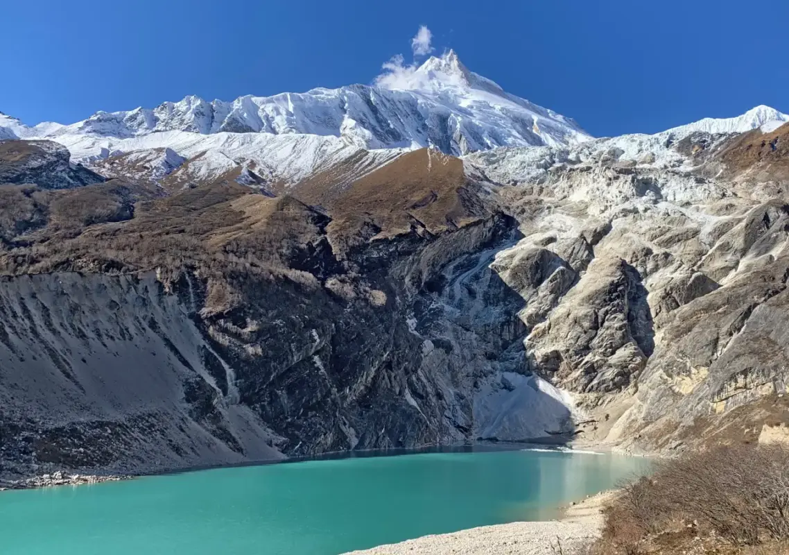
Trekking to Manaslu Base Camp is a high-altitude day hike from Sama Gaun, rather than an overnight stay at Base Camp. A typical route ascends from Sama Gaun (around 3,530 m) up to Birendra Lake and the area near the Manaslu glacier, reaching an elevation of about 4,800 m before returning to Sama Gaun.
As you climb higher, expect increasingly rugged trails, with rocky sections, glacial terrain, exposed slopes, and thinner air. The reward is the scenery, you get closer views of Manaslu and the surrounding Himalayan peaks with every step.
The return to Sama Gaun is an essential part of the acclimatization plan, sleeping at around 3,530 m gives your body time to recover from the day’s high-altitude exposure. Don’t judge the difficulty by distance alone, a 14 km round trip at 4,000–4,800 m can be far more demanding than the same distance at lower elevations.
Likewise, the hike from Shyala village to Pungyen (Pung Gyen) Gompa is a demanding climb through rocky, narrow sections, with an easier, more gradual stretch near the end. Pungyen Gompa is an old, sacred Buddhist monastery built in the early 17th century, located at approximately 4,000 m on the southwest side of the Manaslu massif. The hike offers stunning views of the upper Manaslu region, including Mount Manaslu, Himal Chuli, Ngadi Chuli, Naike Peak, and more.
The day trip to the Tibet border from Samdo is another rewarding addition to the Manaslu Base Camp Larke Pass Trek. The hike is challenging, given the high altitude above 4,000 m, but rewards trekkers with scenic mountain and valley views, along with the chance to spot local wildlife. Since there are no settlements along this route, be sure to carry snacks, food, and water with you.
Why Manaslu Base Camp Larke Pass Trek with Explore Vision Nepal?
The Manaslu Base Camp Larke Pass Trek by Explore Vision Nepal is for those travelers who need assistance in logistics, guidance and restricted area permits. We provide licensed guides, trekking support, accommodation, food, and transport services.
Moreover, as a legally registered local company, Explore Vision Nepal emphasizes village and community-based tourism. This would be helpful during this remote mountain journey where local knowledge matters.
You will not simply have someone to walk along with you but your guide is the one who monitors your speed, dehydration, altitude sickness symptoms and acclimatization. He also assesses the weather and trail conditions before the crossing of the Larkya La pass.
Furthermore, EVN can help arrange the necessary permits for restricted area trekking. We also have a proper emergency procedure, travel insurance requirement, and evacuation plan. These aspects are more critical than any marketing statements about being the “Best”.


Outline Itinerary of Manaslu Base Camp Larke Pass Trek – 15 Days
Day 01: Kathmandu Arrival (Tribhuvan International Airport) (1,400M|4,590Ft)
Day 02: Drive from Kathmandu to Machha Khola (870M|2850Ft), Distance: Approximately 160 Km, Duration: 7-8 Hours
Day 03: Trek From Machha Khola To Jagat (1,380M|4,525Ft), Distance: Approximately 20-22 Km, Duration: 7-8 Hours
Day 04: Trek From Jagat To Deng Village (1,860M|6,100Ft), Distance: 20-22 Km, Duration: 8 Hours
Day 05: Trek from Deng to Namrung (2,630M|8,625Ft), Distance: 18-19 Km, Duration: 7-8 Hours
Day 06: Trek From Namrung To Shyala (Syala) Village (3,500M|11,480Ft), Distance: 13-14 Km, Duration: 6 Hours
Day 07: Shyala to Pungyen Gompa (Monastery) (4,000M|13,120Ft) Hike, then, Trek to Samagaun (3,530M|11,580Ft) Distance: Approximately 14 Km, Duration: 7-8 Hours
Day 08: Day Trip to Manaslu Base Camp (4,800M|15,745Ft) and Back, Distance: Approximately 14 Km round trip, Duration: 8 Hours
Day 09: Trek from Samagaun to Samdo Village (3,860M|12,660Ft), Distance: Approximately 7 Km, Duration: 3-4 Hours
Day 10: Acclimatization Day, Day Trip to Tibet Border Viewpoint (4,800-5,000M), Distance: Approximately 10 - 12 Km Round Trip, Duration: 7-8 Hours
Day 11: Trek from Samdo To Dharmashala (4,460M|14,630Ft), Distance: 6-7 Km, Duration: 5 Hours
Day 12: Trek from Dharmasala to Bimthang (Bhimtang) (3,720M|12,200Ft) Via Larkya La Pass (5,106M|16,750Ft), Distance: Approximately 23 Km, Duration: 8-9 Hours
Day 13: Trek from Bimthang to Goa (Gowa) Village (2,515M|8,250Ft), Distance: 15 Km, Duration: 6-7 Hours
Day 14: Drive from Goa to Kathmandu via Besisahar, Distance: Approximately 240 Km, Duration: 8-10 Hours
Day 15: Farewell | Departure
Trip Highlights
- Stand at the base of the giant Manaslu Peak, at an elevation of approximately 4,800 meters.
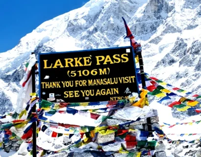
- Pass through the Larkya La Pass, the highest altitude on the trek at around 5,106 meters.
- Get to enjoy the view of the mount Manaslu (8,163 m) and its neighboring Himalayan peaks.
- Visit the old and famous Buddhist temple above the Manaslu region, Pungyen Gompa (Monastery)
- Explore Sama Gaun, the main high altitude settlement of the upper Manaslu region.
- Utilize the acclimatization day in Samdo for hiking towards the Tibet border and spend the time at the Tibetan-border viewpoint.
- Hike through river gorges, forest areas, hanging bridges and cultural villages of the Budhi Gandaki Valley and Manaslu circuit region.
- Explore the Gurung and Tibetan influenced villages, mani walls, chortens and monasteries.
- Trek across a variety of landscapes from sub-tropical valleys to alpine glacial regions.
Itinerary Overview of Manaslu Base Camp Larke Pass Trek – 15 Days
The Manaslu Base Camp Larke Pass Trek – 15 Days, follows an anti-clockwise circuit. Starting from Kathmandu to Machha Khola, the trip goes through the Budhi Gandaki Valley, over Larkya La and back to Kathmandu via Dharapani and Besisahar.
The walking part of the journey starts from Machha Khola and goes uphill all the way to Jagat, Deng, Namrung, Shyala and Sama Gaun, Samdo, Dharmashala and Bhimtang. The landscape changes from lush lower valleys to rugged alpine terrain as you gain elevation.
Once in Sama Gaun, the itinerary takes a dedicated side trip to Manaslu Base Camp before looping back to the village. Then you proceed on to Samdo and Dharmashala. Here you prepare for the trek’s most demanding day, crossing Larkya La Pass and descending to Bimthang (also spelled as Bhimtang).
After the Larkya La pass, the trail gradually drops. The landscapes get increasingly green. The descent ends in Gowa (also spelled Gho or Goa – a small village located in between Manaslu and Annapurna region). From Goa, the road journey brings the trek back toward Besisahar and then Kathmandu, completing the 15-day Manaslu circuit.
Manaslu Base Camp Larke Pass Trek – 15 Days Itinerary
01
Day 01: Kathmandu Arrival (Tribhuvan International Airport) (1,400M|4,590Ft)
Upon landing at Tribhuvan International Airport, you will be met by one of our representatives who will take you to your hotel. The rest of the day is available for your relaxation or to visit the nearby streets of Kathmandu.
This day is not a part of the trekking itinerary. It is a good opportunity to recover from your travel fatigue and get prepared for the upcoming days. Our crew will brief you on the 15-day Manaslu Base Camp Trek, check your trekking gear and help you finalize some other pending matters.

Activity: Drive

Max. Altitude: 1,400m/4,593ft. (Kathmandu)

Accommodation: Hotel
02
Day 02: Drive from Kathmandu to Machha Khola (870M|2850Ft), Distance: Approximately 160 Km, Duration: 7-8 Hours
Today, you will travel from Kathmandu to Machha Khola where you begin trekking. You will drive along the Prithvi Highway till you head for Malekhu, then Dhading Besi, Arughat and Soti Khola along the branch roads. The landscapes change from cityscapes to terraces, small villages and the valley of Budhi Gandaki.
The initial stages of the trip are easy; however, the road gets more difficult after Arughat and Soti Khola. There can be some bumps on the road and winding paths especially on the last part of your drive to Machha Khola.
Your destination, Machha Khola, sits beside the Budhi Gandaki River. Once you arrive, you will check into your teahouse, dine and rest before your first trekking day.
Activity: Drive
Max. Altitude: 870m/2,854ft. (Machha Khola)

Meal: Breakfast, Lunch, Dinner
Accommodation: Guesthouse
03
Day 03: Trek From Machha Khola To Jagat (1,380M|4,525Ft), Distance: Approximately 20-22 Km, Duration: 7-8 Hours
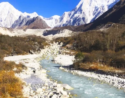
The trail on day 1 of trekking, follows the Budhi Gandaki River, from Machha Khola all the way up to Jagat. You will walk along the trails in the forest, across suspension bridges, rocky terrain and even stone steps.
The trek passes through the villages of Khorlabesi and Tatopani. Tatopani gives you the chance to stop by for a while to relax and soak in the hot springs. Next comes Dobhan (Dovan) and some more narrow parts of the gorge.
Despite the moderate elevation, the day can be challenging due to the several ascents and descents of the trails, with some old landslide part to cross. Along the way, you will walk across numerous bridges and through subtropical vegetation before getting to Jagat. There is a checkpoint for your trekking permit before continuing deeper into the Manaslu restricted area.
Activity: Trekking
Max. Altitude: 1,380m/4,528ft. (Jagat )
Meal: Breakfast, Lunch, Dinner
Accommodation: Guesthouse
04
Day 04: Trek From Jagat To Deng Village (1,860M|6,100Ft), Distance: 20-22 Km, Duration: 8 Hours
Today you move further towards Deng from Jagat along the Budhi Gandaki Valley. The path ascends and descends through Salleri and Sirdibas before taking you to the village of Philim. Philim is one of the bigger villages along the way, where you need to check your MCAP permits and some paperwork. From here, the valley becomes narrower and the surroundings feel increasingly remote.
On the way, you walk through forests and small villages, crossing suspension bridges above the Budhi Gandaki River and few other smaller rivers. You may observe many mani walls, chortens and Buddhist prayer flags as Tibetan cultural influence becomes stronger. After crossing a long suspension bridge, we you will on the other side of the river, then follow the long walk though the forests and narrow valley. Eventually, you will reach the destination village of Deng, a small settlement above the river.
It will be quite a long walking day despite relatively low altitude gain.
Activity: Trekking
Max. Altitude: 1,860m/6,102ft. (Deng Village )
Meal: Breakfast, Lunch, Dinner
Accommodation: Guesthouse
05
Day 05: Trek from Deng to Namrung (2,630M|8,625Ft), Distance: 18-19 Km, Duration: 7-8 Hours
Today you will ascend from Deng and trek steadily up the valley of Budhi Gandaki towards Namrung. You will pass through the Budhi Gandaki River, forest patches, villages and stony areas. Rana, Bihi Phedi, Ghap are some of the scenic settlements you will encounter along the route.
The day marks the beginning of significant elevation gain in the trek. The route is not continuously steep, but repeated climbs make the day physically demanding.
The vegetation also starts changing as you rise up, with more pines, firs and rhododendrons. The last part of the walking is difficult as you need to climb steep uphill to the village. Namrung is a good place to rest with views of the Himalayan Mountains on clear days.
Activity: Trekking
Max. Altitude: 2,630m/8,629ft. (Namrung )
Meal: Breakfast, Lunch, Dinner
Accommodation: Guesthouse
06
Day 06: Trek From Namrung To Shyala (Syala) Village (3,500M|11,480Ft), Distance: 13-14 Km, Duration: 6 Hours
Today you will trek from Namrung to Shyala after breakfast at the guesthouse. From today, the scenery transforms from the forests to the open alpine landscape. You will see the dramatic mountain views as you climb higher. The trail takes you through Lihi, Sho and Lho Village. You will come across stone houses, barley farms, mani walls and Buddhist monuments. Lho is a significant stop on the way and will give you the first grand views of Mount Manaslu.
After Lho, the route goes through pine and rhododendron forests, and finally opens up to the exte
nsive valley of Shyala. The last stretch might feel steep, especially after several days of trekking but the relatively short distance makes it an easier day than the long lower-valley stages.
The views at Shyala, which is 3,500 m high, are impressive, with the surrounding mountain scenery of the Manaslu range and the holy monastery near the village.
Activity: Trekking
Max. Altitude: 3,500m/11,483ft. (Shyala Village )
Meal: Breakfast, Lunch, Dinner
Accommodation: Guesthouse
07
Day 07: Shyala to Pungyen Gompa (Monastery) (4,000M|13,120Ft) Hike, then, Trek to Samagaun (3,530M|11,580Ft) Distance: Approximately 14 Km, Duration: 7-8 Hours
Breakfast will be served in Shyala, then you begin your journey out of the village by taking the side trail leading to Pungyen Gompa. At first, you begin climbing up through open alpine terrain, with Mount Manaslu, Himalchuli, Ngadi Chuli and the glaciers becoming more visible. The trail starts to become steeper as you move to higher pastures and the glacier zone.
Pungyen Gompa is located in the peaceful mountainous area off the main trail. There will be enough time to explore the monastery and enjoy the close view of Mount Manaslu. Additionally, this hike is ideal for acclimatization as you go up during the day and sleep lower down in the evening.
Later, after visiting the monastery and exploring the surroundings, you head back to the trail that leads to Samagaun. You will walk down through the yak pastures and the rocky terrain until the valley of the village comes into sight.
The Sama gaun is the largest settlement of the upper Nubri Valley in Manaslu region. Having checked in at the teahouse, you will have an opportunity to relax before tomorrow’s trek to Manaslu Base Camp.
Activity: Trekking
Max. Altitude: 3,530m/11,581ft. (Samagaun )
Meal: Breakfast, Lunch, Dinner
Accommodation: Guesthouse
08
Day 08: Day Trip to Manaslu Base Camp (4,800M|15,745Ft) and Back, Distance: Approximately 14 Km round trip, Duration: 8 Hours
This is one of the toughest but most enjoyable days on the Manaslu Base Camp Trek. Leaving early from Samagaun, you will make your way to the Birendra Lake through steeper mountain terrain all the way to Manaslu Base Camp.
The route gains roughly 1,270 m in elevation and the hike will be tougher due to the thinner atmosphere rather than simply by the distance alone.
As the altitude increases, you get better views of Mount Manaslu and the Manaslu Glacier, among others. Birendra Lake is the most notable landmark during this trek, and the area leading to the Base Camp can be steep, rough and snowy depending on the season.
You rest and explore at the Base Camp for a short time before retracing your steps back to Sama Gaun. Throughout the day, your guide will keep track of your pace and physical condition. You will have another overnight stay in Sama Gaun at the same guesthouse.
Activity: Trekking
Max. Altitude: 3,530m/11,581ft. (Manaslu Base Camp - Samagaun )
Meal: Breakfast, Lunch, Dinner
Accommodation: Guesthouse
09
Day 09: Trek from Samagaun to Samdo Village (3,860M|12,660Ft), Distance: Approximately 7 Km, Duration: 3-4 Hours
We are on day 9 of the 15 days Manaslu trek itinerary. Although it is a short trekking day, the altitude will require you to walk steadily and slowly.
The route leads through the valley of the Budhi Gandaki River across the open alpine meadows and yak pastures. Trees gradually disappear because the route passes above the tree line.
Long mani walls and the crossing of the Budhi Gandaki River precede the last gentle rise to the village of Samdo. The scenery around is much more barren and rocky than in the lower part of the Manaslu Circuit trek, with Manaslu and other Himalayan peaks in sight.
Samdo is an old settlement influenced by Tibetan architecture situated near the border of Nepal and Tibet. Arriving there, you may have lunch and relax a little at the teahouse and enjoy the surroundings.
Activity: Trekking
Max. Altitude: 3,860m/12,664ft. (Samdo Village)
Meal: Breakfast, Lunch, Dinner
Accommodation: Guesthouse
10
Day 10: Acclimatization Day, Day Trip to Tibet Border Viewpoint (4,800-5,000M), Distance: Approximately 10 - 12 Km Round Trip, Duration: 7-8 Hours
It is an important acclimatization day in Samdo prior to going to Dharmasala via Larkya La Pass. Rather than simply resting, you take a gradual day hike to the Nepal-Tibet border. The walk is along the ancient trans-Himalayan trade route across grassy yak pastures and stony terrain.
As you ascend higher, the scenery becomes increasingly spectacular with Samdo Glacier, Himalayan Mountains all around and the alpine valleys extending towards Tibet. This is also one of the locations where Himalayan animals like blue sheep and marmots are likely to be spotted.
Following your visit to the viewpoint, you come down the same trail back to Samdo. This process aids in getting your body used to higher altitudes. You then rest, hydrate and prepare for tomorrow’s trek to Dharmashala.
Activity: Trekking
Max. Altitude: 3,860m/12,664ft. (Tibet border - Samdo )
Meal: Breakfast, Lunch, Dinner
Accommodation: Guesthouse
11
Day 11: Trek from Samdo To Dharmashala (4,460M|14,630Ft), Distance: 6-7 Km, Duration: 5 Hours
This is day eleven of the Manaslu Base Camp Larke Pass Trek itinerary. It is a short but important section of the trek. You make your way from Samdo to Dharmasala (also called Larkya Phedi). With the increasing altitude along this route, the hike is tougher than its distance implies.
You will begin by descending to the Budhi Gandaki River where you cross a wooden bridge. You then ascend gradually to a dry and rocky terrain with little vegetation. This is when you encounter the seasonal market of Larkya Bazaar which was historically linked with the Tibet trade route. Further up, you can enjoy views of Larkya Glacier and surrounding peaks.
Dharmasala is not really a mountain village but a basic high altitude settlement. There are not many lodging options here and you will only get simple shared rooms and basic dining areas. Take a break after your lunch, hydrate yourself, get some rest and get ready for tomorrow’s Larkya La Pass hike. Your guide will brief you about the early start and trail conditions.
Activity: Trekking
Max. Altitude: 4,460m/14,633ft. (Dharmashala )
Meal: Breakfast, Lunch, Dinner
Accommodation: Guesthouse
12
Day 12: Trek from Dharmasala to Bimthang (Bhimtang) (3,720M|12,200Ft) Via Larkya La Pass (5,106M|16,750Ft), Distance: Approximately 23 Km, Duration: 8-9 Hours
This day is considered the hardest one on the Manaslu Base Camp Circuit Trek. You will start early morning today, around 4:00 AM, since it will become harder to travel through the pass in case of changes in weather conditions in the afternoon.
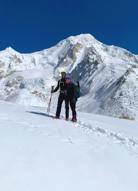
You will walk across rocks and glacial terrain towards the Larkya Glacier. As the altitude rises, the temperature gets colder, and the air thinner. The ascent to Larkya La Pass is slow and demanding.
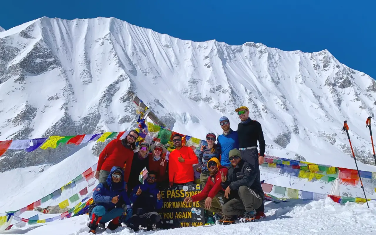
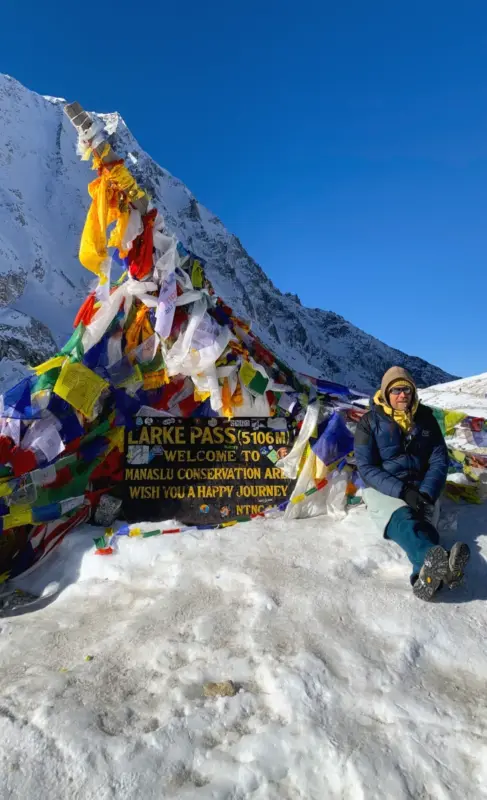
The top of this pass treats you to the panorama of the Himalayan mountains like Himlung Himal, Larkya Peak, Cheo Himal, Kang Guru, Annapurna II and more. The prayer flags around the pass flutter in the mountain breeze which adds to a spiritual and serene atmosphere of this high-altitude landscape.
After a short break and celebration at the top, you will start the long descent to Bimthang. Some sections can be loose, snowy or slippery, need to be careful. The scenery changes gradually from Barren Mountain to green alpine meadows. Once in Bimthang, you will have a rest after one of the hardest days of the trek.
Activity: Trekking | Mountain Pass
Max. Altitude: 3,716m/12,192ft. (Bhimthang )
Meal: Breakfast, Lunch, Dinner
Accommodation: Guesthouse
13
Day 13: Trek from Bimthang to Goa (Gowa) Village (2,515M|8,250Ft), Distance: 15 Km, Duration: 6-7 Hours
This is another easy part of the Manaslu Circuit Trek that follows the downhill route after the previous strenuous crossing of Larkya La. The distance is medium, but you will be descending, which means that your knee joints will feel the effect after yesterday’s long hike.
The route goes along Dudh Khola, which is surrounded by forested slopes, pastures, and some small villages. With decreasing altitude, you see the changes from the bare mountains and the chilly climate of Larkya La into the warm, green valleys. Besides, you can enjoy a wonderful view of the Manaslu massif while going down.
After passing places like Yak Kharka and Karche, you will come to the village of Goa (Gho). It is a traditional Gurung settlement with some teahouses where you can have a rest.
Activity: Trekking
Max. Altitude: 2,500m/8,202ft. (Goa (Gowa))
Meal: Breakfast, Lunch, Dinner
Accommodation: Guesthouse
14
Day 14: Drive from Goa to Kathmandu via Besisahar, Distance: Approximately 240 Km, Duration: 8-10 Hours
After breakfast, you start your journey back towards Kathmandu via the road marking the end of the Manaslu trek. The road passes along the Marshyangdi River, through the mountain valleys until you reach Besisahar. After leaving Besisahar, the journey will continue through the main road towards Kathmandu.
Dharapani to Besisahar follows a mountain road which can be bumpy in some places. During the drive, you will come across several villages, terraces, waterfalls, and valleys, and the scenery will rapidly change from mountains to lower hills.
Besisahar is a transport hub where there will be some changes in your vehicle arrangement for the further part of the drive towards Kathmandu. After Besisahar, the road will become easy, but traffic will be heavier around the Kathmandu Valley area.
You should expect to reach Kathmandu in the late afternoon or evening. After two weeks in the mountains, this is a good time to rest, enjoy proper shower and a comfortable evening in the city.
Activity: Drive
Max. Altitude: 1,400m/4,593ft. (Kathmandu )
Meal: Breakfast
Accommodation: Hotel
15
Day 15: Farewell | Departure
This is the final day. You will have breakfast and then spend some leisure time until your scheduled flight.
We will drop you off at Tribhuvan International Airport depending upon your flight time. You should arrive at the airport at least 3 hours before your international flight so that you have enough time for the check-in, security, and the immigration process.
Before leaving the hotel, please make sure that you have all your important things packed up with you. In case you have some extra time in Kathmandu, you may choose to purchase souvenirs or Nepali handicrafts during the morning hours.
Activity: Drive
Max. Altitude: 1,400m/4,593ft. (Kathmandu )
Meal: Breakfast

Note:
If you have a private group and prefer a personalized experience, we can organize a custom trip tailored to your requirements and group size, running it any day you choose.
Price Includes


Price Excludes

What's included?
- Airport Transfers: Private vehicle transfers between Tribhuvan International Airport and your hotel in Kathmandu, including both arrival and departure.
- Kathmandu Accommodation: 2 nights at a best 3-star category hotel in Kathmandu, including daily breakfast.
- Trekking Meals: Full-board meals throughout the trek, including breakfast, lunch, and dinner, with tea or coffee.
- Trekking Accommodation: Best available local teahouse/lodge accommodation throughout the trekking route on a twin-sharing basis.
- Manaslu Base Camp & Larke Pass Trek Permits: All required trekking permits and conservation fees, including the Manaslu Special Restricted Area Permit (RAP), Manaslu Conservation Area Permit (MCAP), and Annapurna Conservation Area Permit (ACAP).
- Private Ground Transportation: Private vehicle transportation from Kathmandu to Machha Khola at the beginning of the trek and from Tilije back to Kathmandu after completing the trekking route.
- Experienced Trekking Guide: A government-licensed, highly experienced, and professional English-speaking trekking guide throughout the journey.
- Porter Service: Porter support for carrying your main trekking duffel bag, one porter in between two trekkers
- Trekking Staff Costs: Guide and porter wages, meals, accommodation, transportation, required equipment, and accidental insurance are fully covered.
- Trekking Equipment: Company-provided duffle bag, down jacket, and sleeping bag for use during the trek.
- Trekking Map: A detailed trekking map to help you follow and understand the Manaslu and Larke Pass route.
- Company T-Shirt: Complimentary Explore Vision Nepal T-shirt as a memorable part of your trekking experience.
- Trek Achievement Certificate: Official trekking completion certificate presented after successfully completing the trek.
- First Aid Support: A comprehensive first-aid medical kit carried by the trekking guide throughout the trek.
- Seasonal Fresh Fruit: Fresh seasonal fruit served after dinner during the trekking journey, subject to availability.
- Permit and Documentation Assistance: Arrangement and processing of the necessary trekking permits and related documentation.
- Government Taxes and Service Charges: Applicable local and national government taxes, permit-related charges, and company service fees are included in the package price.
- Trip Coordination: Pre-trek briefing and assistance from our team in Kathmandu to help you prepare for the Manaslu Base Camp and Larke Pass adventure.
What's not included?
- International Airfare: International flights to and from Nepal.
- Nepal Entry Visa: Nepal visa fee payable upon arrival at Tribhuvan International Airport. Carrying the visa fee in cash, preferably in USD, is recommended.
- Travel Insurance: Comprehensive travel insurance covering high-altitude trekking, medical treatment, emergency evacuation, and trip-related emergencies. Insurance should provide coverage for trekking at altitudes of around 5,000 metres.
- Kathmandu Expenses Outside the Itinerary: Additional hotel nights, meals, drinks, or other services required before or after the scheduled itinerary.
- Personal Trekking Equipment: Personal clothing, trekking boots, trekking poles, backpacks, gloves, sunglasses, and other equipment not specifically mentioned under the inclusions.
- Personal Expenses During the Trek: Bottled water, soft drinks, alcoholic beverages, snacks, chocolate, hot showers, Wi-Fi/internet, mobile data, and electronic device charging fees.
Laundry and Communication: Laundry, telephone calls, and other personal communication or convenience services. - Emergency and Unforeseen Expenses: Any additional costs resulting from illness, injury, early return, flight or transportation delays, road blockages, bad weather, natural events, or other circumstances beyond our control.
- Additional Services: Any accommodation, meals, transportation, permits, activities, or services not specifically mentioned under Cost Inclusions .
- Tips and Gratuities: Tips for the trekking guide, porters, drivers, and other supporting staff. Tipping is not mandatory, but it is customary and greatly appreciated for good service.
Departure Dates
Start Date
26 Oct 2026End Date
10 Nov 2026Price
US$ 1450
 Guaranteed
Start Date
27 Oct 2026End Date
11 Nov 2026Price
US$ 1450
Guaranteed
Start Date
30 Oct 2026End Date
14 Nov 2026Price
US$ 1450
Guaranteed
Start Date
01 Nov 2026End Date
16 Nov 2026Price
US$ 1450
Guaranteed
Start Date
02 Nov 2026End Date
17 Nov 2026Price
US$ 1450
Guaranteed
Start Date
03 Nov 2026End Date
18 Nov 2026Price
US$ 1450
Guaranteed
Start Date
04 Nov 2026End Date
19 Nov 2026Price
US$ 1450
Guaranteed
Start Date
05 Nov 2026End Date
20 Nov 2026Price
US$ 1450
Guaranteed
Start Date
07 Nov 2026End Date
22 Nov 2026Price
US$ 1450
Guaranteed
Start Date
10 Nov 2026End Date
25 Nov 2026Price
US$ 1450
Guaranteed
Start Date
11 Nov 2026End Date
26 Nov 2026Price
US$ 1450
Guaranteed
Start Date
12 Nov 2026End Date
27 Nov 2026Price
US$ 1450
Guaranteed
Start Date
13 Nov 2026End Date
28 Nov 2026Price
US$ 1450
Guaranteed
Start Date
17 Nov 2026End Date
02 Dec 2026Price
US$ 1450
Guaranteed
Start Date
20 Nov 2026End Date
05 Dec 2026Price
US$ 1450
Guaranteed
Start Date
21 Nov 2026End Date
06 Dec 2026Price
US$ 1450
Guaranteed
Start Date
22 Nov 2026End Date
07 Dec 2026Price
US$ 1450
Guaranteed
Start Date
24 Nov 2026End Date
09 Dec 2026Price
US$ 1450
Guaranteed
Start Date
25 Nov 2026End Date
10 Dec 2026Price
US$ 1450
Guaranteed
Start Date
26 Nov 2026End Date
11 Dec 2026Price
US$ 1450
Guaranteed
Start Date
27 Nov 2026End Date
12 Dec 2026Price
US$ 1450
Guaranteed
Start Date
28 Nov 2026End Date
13 Dec 2026Price
US$ 1450
Guaranteed
Start Date
29 Nov 2026End Date
14 Dec 2026Price
US$ 1450
Guaranteed
Start Date
01 Dec 2026End Date
16 Dec 2026Price
US$ 1450
Guaranteed
Start Date
02 Dec 2026End Date
17 Dec 2026Price
US$ 1450
Guaranteed
Start Date
03 Dec 2026End Date
18 Dec 2026Price
US$ 1450
Guaranteed
Start Date
05 Dec 2026End Date
20 Dec 2026Price
US$ 1450
Guaranteed
Start Date
06 Dec 2026End Date
21 Dec 2026Price
US$ 1450
Guaranteed
Start Date
09 Dec 2026End Date
24 Dec 2026Price
US$ 1450
Guaranteed
Start Date
14 Dec 2026End Date
29 Dec 2026Price
US$ 1450
Guaranteed
Start Date
15 Dec 2026End Date
30 Dec 2026Price
US$ 1450
Guaranteed
Start Date
24 Dec 2026End Date
08 Jan 2027Price
US$ 1450
Guaranteed
Start Date
25 Dec 2026End Date
09 Jan 2027Price
US$ 1450
Guaranteed
Start Date
01 Jan 2027End Date
16 Jan 2027Price
US$ 1450
Guaranteed
Start Date
02 Jan 2027End Date
17 Jan 2027Price
US$ 1450
Guaranteed
Start Date
05 Jan 2027End Date
20 Jan 2027Price
US$ 1450
Guaranteed
Start Date
09 Jan 2027End Date
24 Jan 2027Price
US$ 1450
Guaranteed
Start Date
10 Jan 2027End Date
25 Jan 2027Price
US$ 1450
Guaranteed
Start Date
11 Jan 2027End Date
26 Jan 2027Price
US$ 1450
Guaranteed
Start Date
12 Jan 2027End Date
27 Jan 2027Price
US$ 1450
Guaranteed
Start Date
20 Jan 2027End Date
04 Feb 2027Price
US$ 1450
Guaranteed
Start Date
21 Jan 2027End Date
05 Feb 2027Price
US$ 1450
Guaranteed
Start Date
22 Jan 2027End Date
06 Feb 2027Price
US$ 1450
Guaranteed
Start Date
29 Jan 2027End Date
13 Feb 2027Price
US$ 1450
Guaranteed
Start Date
02 Feb 2027End Date
17 Feb 2027Price
US$ 1450
Guaranteed
Start Date
07 Feb 2027End Date
22 Feb 2027Price
US$ 1450
Guaranteed
Start Date
08 Feb 2027End Date
23 Feb 2027Price
US$ 1450
Guaranteed
Start Date
18 Feb 2027End Date
05 Mar 2027Price
US$ 1450
Guaranteed
Start Date
19 Feb 2027End Date
06 Mar 2027Price
US$ 1450
Guaranteed
Start Date
25 Feb 2027End Date
12 Mar 2027Price
US$ 1450
Guaranteed
Start Date
01 Mar 2027End Date
16 Mar 2027Price
US$ 1450
Guaranteed
Start Date
02 Mar 2027End Date
17 Mar 2027Price
US$ 1450
Guaranteed
Start Date
03 Mar 2027End Date
18 Mar 2027Price
US$ 1450
Guaranteed
Start Date
07 Mar 2027End Date
22 Mar 2027Price
US$ 1450
Guaranteed
Start Date
08 Mar 2027End Date
23 Mar 2027Price
US$ 1450
Guaranteed
Start Date
10 Mar 2027End Date
25 Mar 2027Price
US$ 1450
Guaranteed
Start Date
11 Mar 2027End Date
26 Mar 2027Price
US$ 1450
Guaranteed
Start Date
12 Mar 2027End Date
27 Mar 2027Price
US$ 1450
Guaranteed
Start Date
16 Mar 2027End Date
31 Mar 2027Price
US$ 1450
Guaranteed
Start Date
17 Mar 2027End Date
01 Apr 2027Price
US$ 1450
Guaranteed
Start Date
18 Mar 2027End Date
02 Apr 2027Price
US$ 1450
Guaranteed
Start Date
23 Mar 2027End Date
07 Apr 2027Price
US$ 1450
Guaranteed
Start Date
27 Mar 2027End Date
11 Apr 2027Price
US$ 1450
Guaranteed
Start Date
28 Mar 2027End Date
12 Apr 2027Price
US$ 1450
Guaranteed
Start Date
29 Mar 2027End Date
13 Apr 2027Price
US$ 1450
Guaranteed
Start Date
01 Apr 2027End Date
16 Apr 2027Price
US$ 1450
Guaranteed
Start Date
02 Apr 2027End Date
17 Apr 2027Price
US$ 1450
Guaranteed
Start Date
03 Apr 2027End Date
18 Apr 2027Price
US$ 1450
Guaranteed
Start Date
04 Apr 2027End Date
19 Apr 2027Price
US$ 1450
Guaranteed
Start Date
06 Apr 2027End Date
21 Apr 2027Price
US$ 1450
Guaranteed
Start Date
12 Apr 2027End Date
27 Apr 2027Price
US$ 1450
Guaranteed
Start Date
13 Apr 2027End Date
28 Apr 2027Price
US$ 1450
Guaranteed
Start Date
14 Apr 2027End Date
29 Apr 2027Price
US$ 1450
Guaranteed
Start Date
19 Apr 2027End Date
04 May 2027Price
US$ 1450
Guaranteed
Start Date
20 Apr 2027End Date
05 May 2027Price
US$ 1450
Guaranteed
Start Date
26 Apr 2027End Date
11 May 2027Price
US$ 1450
Guaranteed
Start Date
27 Apr 2027End Date
12 May 2027Price
US$ 1450
Guaranteed
Start Date
02 May 2027End Date
17 May 2027Price
US$ 1450
Guaranteed
Start Date
04 May 2027End Date
19 May 2027Price
US$ 1450
Guaranteed
Start Date
05 May 2027End Date
20 May 2027Price
US$ 1450
Guaranteed
Start Date
06 May 2027End Date
21 May 2027Price
US$ 1450
Guaranteed
Start Date
07 May 2027End Date
22 May 2027Price
US$ 1450
Guaranteed
Start Date
11 May 2027End Date
26 May 2027Price
US$ 1450
Guaranteed
Start Date
12 May 2027End Date
27 May 2027Price
US$ 1450
Guaranteed
Start Date
13 May 2027End Date
28 May 2027Price
US$ 1450
Guaranteed
Start Date
14 May 2027End Date
29 May 2027Price
US$ 1450
Guaranteed
Start Date
18 May 2027End Date
02 Jun 2027Price
US$ 1450
Guaranteed
Start Date
25 May 2027End Date
09 Jun 2027Price
US$ 1450
Guaranteed
Start Date
26 May 2027End Date
10 Jun 2027Price
US$ 1450
Guaranteed
Start Date
27 May 2027End Date
11 Jun 2027Price
US$ 1450
Guaranteed
Start Date
28 May 2027End Date
12 Jun 2027Price
US$ 1450
Guaranteed
Start Date
01 Jun 2027End Date
16 Jun 2027Price
US$ 1450
Guaranteed
Start Date
02 Jun 2027End Date
17 Jun 2027Price
US$ 1450
Guaranteed
Start Date
05 Jun 2027End Date
20 Jun 2027Price
US$ 1450
Guaranteed
Start Date
09 Jun 2027End Date
24 Jun 2027Price
US$ 1450
Guaranteed
Start Date
10 Jun 2027End Date
25 Jun 2027Price
US$ 1450
Guaranteed
Start Date
11 Jun 2027End Date
26 Jun 2027Price
US$ 1450
Guaranteed
Start Date
12 Jun 2027End Date
27 Jun 2027Price
US$ 1450
Guaranteed
Start Date
17 Jun 2027End Date
02 Jul 2027Price
US$ 1450
Guaranteed
Start Date
23 Jun 2027End Date
08 Jul 2027Price
US$ 1450
Guaranteed
Start Date
24 Jun 2027End Date
09 Jul 2027Price
US$ 1450
Guaranteed
Start Date
25 Jun 2027End Date
10 Jul 2027Price
US$ 1450
Guaranteed
Start Date
03 Jul 2027End Date
18 Jul 2027Price
US$ 1450
Guaranteed
Start Date
07 Jul 2027End Date
22 Jul 2027Price
US$ 1450
Guaranteed
Start Date
08 Jul 2027End Date
23 Jul 2027Price
US$ 1450
Guaranteed
Start Date
15 Jul 2027End Date
30 Jul 2027Price
US$ 1450
Guaranteed
Start Date
16 Jul 2027End Date
31 Jul 2027Price
US$ 1450
Guaranteed
Start Date
22 Jul 2027End Date
06 Aug 2027Price
US$ 1450
Guaranteed
Start Date
23 Jul 2027End Date
07 Aug 2027Price
US$ 1450
Guaranteed
Start Date
29 Jul 2027End Date
13 Aug 2027Price
US$ 1450
Guaranteed
Start Date
01 Aug 2027End Date
16 Aug 2027Price
US$ 1450
Guaranteed
Start Date
02 Aug 2027End Date
17 Aug 2027Price
US$ 1450
Guaranteed
Start Date
03 Aug 2027End Date
18 Aug 2027Price
US$ 1450
Guaranteed
Start Date
06 Aug 2027End Date
21 Aug 2027Price
US$ 1450
Guaranteed
Start Date
07 Aug 2027End Date
22 Aug 2027Price
US$ 1450
Guaranteed
Start Date
08 Aug 2027End Date
23 Aug 2027Price
US$ 1450
Guaranteed
Start Date
11 Aug 2027End Date
26 Aug 2027Price
US$ 1450
Guaranteed
Start Date
15 Aug 2027End Date
30 Aug 2027Price
US$ 1450
Guaranteed
Start Date
16 Aug 2027End Date
31 Aug 2027Price
US$ 1450
Guaranteed
Start Date
17 Aug 2027End Date
01 Sep 2027Price
US$ 1450
Guaranteed
Start Date
22 Aug 2027End Date
06 Sep 2027Price
US$ 1450
Guaranteed
Start Date
23 Aug 2027End Date
07 Sep 2027Price
US$ 1450
Guaranteed
Start Date
24 Aug 2027End Date
08 Sep 2027Price
US$ 1450
Guaranteed
Start Date
25 Aug 2027End Date
09 Sep 2027Price
US$ 1450
Guaranteed
Start Date
28 Aug 2027End Date
12 Sep 2027Price
US$ 1450
Guaranteed
Start Date
02 Sep 2027End Date
17 Sep 2027Price
US$ 1450
Guaranteed
Start Date
03 Sep 2027End Date
18 Sep 2027Price
US$ 1450
Guaranteed
Start Date
06 Sep 2027End Date
21 Sep 2027Price
US$ 1450
Guaranteed
Start Date
07 Sep 2027End Date
22 Sep 2027Price
US$ 1450
Guaranteed
Start Date
08 Sep 2027End Date
23 Sep 2027Price
US$ 1450
Guaranteed
Start Date
11 Sep 2027End Date
26 Sep 2027Price
US$ 1450
Guaranteed
Start Date
13 Sep 2027End Date
28 Sep 2027Price
US$ 1450
Guaranteed
Start Date
14 Sep 2027End Date
29 Sep 2027Price
US$ 1450
Guaranteed
Start Date
15 Sep 2027End Date
30 Sep 2027Price
US$ 1450
Guaranteed
Start Date
18 Sep 2027End Date
03 Oct 2027Price
US$ 1450
Guaranteed
Start Date
22 Sep 2027End Date
07 Oct 2027Price
US$ 1450
Guaranteed
Start Date
23 Sep 2027End Date
08 Oct 2027Price
US$ 1450
Guaranteed
Start Date
24 Sep 2027End Date
09 Oct 2027Price
US$ 1450
Guaranteed
Start Date
25 Sep 2027End Date
10 Oct 2027Price
US$ 1450
Guaranteed
Start Date
28 Sep 2027End Date
13 Oct 2027Price
US$ 1450
Guaranteed
Start Date
29 Sep 2027End Date
14 Oct 2027Price
US$ 1450
Guaranteed
Start Date
01 Oct 2027End Date
16 Oct 2027Price
US$ 1450
Guaranteed
Start Date
02 Oct 2027End Date
17 Oct 2027Price
US$ 1450
Guaranteed
Start Date
04 Oct 2027End Date
19 Oct 2027Price
US$ 1450
Guaranteed
Start Date
05 Oct 2027End Date
20 Oct 2027Price
US$ 1450
Guaranteed
Start Date
08 Oct 2027End Date
23 Oct 2027Price
US$ 1450
Guaranteed
Start Date
10 Oct 2027End Date
25 Oct 2027Price
US$ 1450
Guaranteed
Start Date
11 Oct 2027End Date
26 Oct 2027Price
US$ 1450
Guaranteed
Start Date
12 Oct 2027End Date
27 Oct 2027Price
US$ 1450
Guaranteed
Start Date
13 Oct 2027End Date
28 Oct 2027Price
US$ 1450
Guaranteed
Start Date
16 Oct 2027End Date
31 Oct 2027Price
US$ 1450
Guaranteed
Start Date
21 Oct 2027End Date
05 Nov 2027Price
US$ 1450
Guaranteed
Start Date
22 Oct 2027End Date
06 Nov 2027Price
US$ 1450
Guaranteed
Start Date
23 Oct 2027End Date
07 Nov 2027Price
US$ 1450
Guaranteed
Start Date
26 Oct 2027End Date
10 Nov 2027Price
US$ 1450
Guaranteed
Start Date
27 Oct 2027End Date
11 Nov 2027Price
US$ 1450
Guaranteed
Start Date
28 Oct 2027End Date
12 Nov 2027Price
US$ 1450
Guaranteed
Start Date
02 Nov 2027End Date
17 Nov 2027Price
US$ 1450
Guaranteed
Start Date
04 Nov 2027End Date
19 Nov 2027Price
US$ 1450
Guaranteed
Start Date
05 Nov 2027End Date
20 Nov 2027Price
US$ 1450
Guaranteed
Start Date
06 Nov 2027End Date
21 Nov 2027Price
US$ 1450
Guaranteed
Start Date
08 Nov 2027End Date
23 Nov 2027Price
US$ 1450
Guaranteed
Start Date
10 Nov 2027End Date
25 Nov 2027Price
US$ 1450
Guaranteed
Start Date
11 Nov 2027End Date
26 Nov 2027Price
US$ 1450
Guaranteed
Start Date
12 Nov 2027End Date
27 Nov 2027Price
US$ 1450
Guaranteed
Start Date
13 Nov 2027End Date
28 Nov 2027Price
US$ 1450
Guaranteed
Start Date
15 Nov 2027End Date
30 Nov 2027Price
US$ 1450
Guaranteed
Start Date
19 Nov 2027End Date
04 Dec 2027Price
US$ 1450
Guaranteed
Start Date
20 Nov 2027End Date
05 Dec 2027Price
US$ 1450
Guaranteed
Start Date
21 Nov 2027End Date
06 Dec 2027Price
US$ 1450
Guaranteed
Start Date
25 Nov 2027End Date
10 Dec 2027Price
US$ 1450
Guaranteed
Start Date
26 Nov 2027End Date
11 Dec 2027Price
US$ 1450
Guaranteed
Start Date
02 Dec 2027End Date
17 Dec 2027Price
US$ 1450
Guaranteed
Start Date
03 Dec 2027End Date
18 Dec 2027Price
US$ 1450
Guaranteed
Start Date
05 Dec 2027End Date
20 Dec 2027Price
US$ 1450
Guaranteed
Start Date
06 Dec 2027End Date
21 Dec 2027Price
US$ 1450
Guaranteed
Start Date
07 Dec 2027End Date
22 Dec 2027Price
US$ 1450
Guaranteed
Start Date
10 Dec 2027End Date
25 Dec 2027Price
US$ 1450
Guaranteed
Start Date
11 Dec 2027End Date
26 Dec 2027Price
US$ 1450
Guaranteed
Start Date
18 Dec 2027End Date
02 Jan 2028Price
US$ 1450
Guaranteed
Start Date
25 Dec 2027End Date
09 Jan 2028Price
US$ 1450
Guaranteed
Start Date
26 Dec 2027End Date
10 Jan 2028Price
US$ 1450
Guaranteed
Trip Information
Best Season for the Manaslu Base Camp Larke Pass Trek
Spring (March – May) and autumn (September – November) are the best seasons for trekking in Nepal and the Manaslu Circuit Trek due to good weather and better visibility conditions.
Autumn, particularly in October and November are the best month altogether. The atmosphere is clean after the monsoon, the skies are often clearer and there are better conditions to climb through the high-altitude parts. Spring, especially April to May is more preferred for the rhododendrons’ blossom, warmer temperatures, and pleasant trekking conditions.
Summer/Monsoon (June – August) is not a good season due to heavy rains which can make lower trails muddy. There are also risks of landslides and poor mountain visibility due to the clouds. Winter (December – February) is a very cold season with snow at higher elevations, making the Larkya La section more challenging.
For the 15-day Manaslu Base Camp Trek, October-November is the safest all-round choice for most trekkers, while March-April is the best spring alternative.
Permits Required and Cost for the Manaslu Base Camp Larke Pass Trek
The Manaslu region is a restricted area in Nepal, so trekkers need three separate permits to do the Manaslu Base Camp Larke Pass Trek: the Manaslu Restricted Area Permit (RAP), the Manaslu Conservation Area Permit (MCAP), and the Annapurna Conservation Area Permit (ACAP). Individual trekkers cannot apply for RAP permits on your own, a registered Nepal trekking agency must arrange them on your behalf.
Manaslu Restricted Area Permit (RAP)
This is the main permit for the restricted section of the trek, checked at entry points like Jagat. Its cost depends on the season and how many days you spend inside the restricted area:
- September to November (autumn, peak season): USD 100 per person for the first 7 days, then USD 15 per person for each additional day.
- December to August (winter, spring, and summer): USD 75 per person for the first 7 days, then USD 10 per person for each additional day.
2026 Update Solo Trekkers Allowed: Until March 2026, at least two trekkers had to apply for the RAP together. Nepal’s Department of Immigration has since removed this rule, so solo travelers can now apply for the permit through a registered Nepal agency. A licensed guide from a registered trekking agency is still required by law, this hasn’t changed. You still cannot trek Manaslu independently, with or without a companion.
Manaslu Conservation Area Permit (MCAP)
This covers the conservation area around the Manaslu massif. It’s a one-time fee, not charged per day:
- Foreign nationals: NPR 3,000 per person (roughly USD 20-21 at current exchange rates)
- SAARC nationals: NPR 1,000 per person (roughly USD 7)
Annapurna Conservation Area Permit (ACAP)
Many trekkers are surprised this permit is needed for a Manaslu trek. It’s required because the route doesn’t stay inside the Manaslu region the whole way, after crossing Larkya La Pass, the trail descends through Bimthang and Dharapani, both inside the Annapurna Conservation Area. The cost is the same as MCAP:
- Foreign nationals: NPR 3,000 per person (roughly USD 20-21)
- SAARC nationals: NPR 1,000 per person (roughly USD 7)
Manaslu Trek Permit costs at a Glance
| Permit | Foreign Nationals | SAARC Nationals |
| RAP (Sept-Nov, first 7 days) | USD 100 + USD 15/extra day | USD 100 + USD 15/extra day |
| RAP (Dec-Aug, first 7 days) | USD 75 + USD 10/extra day | USD 75 + USD 10/extra day |
| MCAP (one-time) | NPR 3,000 (USD 20-21) | NPR 1,000 (USD 7) |
| ACAP (one-time) | NPR 3,000 (USD 20-21) | NPR 1,000 (USD 7) |
Note: The RAP rate does not change by nationality. Only MCAP and ACAP offer a SAARC discount.
Training and Physical Preparation for Manaslu Base Camp Trek
It is recommended to begin exercising at least 8–12 weeks before embarking on the trek to the Manaslu Base Camp and Larkya La Pass. It is necessary to prepare yourself for endurance, hill walking, leg muscles and carrying a daypack.
Cardio exercises like brisk walking, running, cycling, stair climbing, or uphill hiking should be done 3-4 times a week. Strength exercises aimed at training quads, hamstrings, calves, glutes, and core should be done twice or three times. Starting from four weeks before departure, weekend hiking and carrying the backpack that will be worn during the trek should be included.
Nevertheless, fitness does not guarantee avoiding altitude sickness. In order to get accustomed to high elevation, gradual ascent and avoiding an increase in sleeping elevation of more than 500 m per day above 3,000 m are recommended during the trek.
The 15-day trekking period requires endurance rather than speed. You don’t need climbing skills but should be prepared for steep paths, rough terrain, long downhill routes and multiple days of continuous hiking.
Altitude Sickness, Acclimatization and Safety on Manaslu Circuit Trek
The signs of altitude sickness could arise from an altitude of 2,500 meters and above. Symptoms include headache, nausea, dizziness, unusual fatigue, and poor appetite.
The most effective prevention is a gradual ascent combined with proper acclimatization. Starting at 3,000 m of height, trekkers should normally ascend no higher than 500 m of sleeping altitude each day and have one extra acclimatization day for every three to four days of ascending.
While trekking, make sure that you walk at a consistent pace without forcing yourself to move fast just to be able to catch up with other trekkers. Drink adequate water and alert your guide immediately if you feel any symptoms of AMS. If symptoms get worse, stop ascending.
Our Manaslu Circuit trekking itinerary involves acclimatization at Sama Gaun and Samdo villages, including a daytime hike toward the Tibet border before returning to sleep at Samdo. Besides, your guides will observe your physical state, pace and acclimatization status in the high altitude area. This helps ensure a safer and more comfortable trekking experience.
Manaslu Base Camp Larke Pass Trek Success Rate
As there is no exact success rate in percentage terms for the Manaslu Base Camp Trek. It can be observed from the facts that the total number of trekkers who went into the Manaslu Restricted Area was 14,720 in 2025. But this doesn’t give the details of how many actually completed the trek.
For a fit trekker with a well planned itinerary and proper acclimatization, trekking the Manaslu region is achievable. Preparation is important. Consistent uphill walking, cardiovascular conditioning, steady pacing, sufficient rest and adequate acclimatization may increase your probability of finishing the 15 day Manaslu trek successfully.
Our guides also watch out for your health, the weather and trail conditions. If altitude sickness or bad weather creates a serious risk, safety comes before reaching the next destination.
How the Manaslu Base Camp Larke Pass Trek Operates
The trek to Manaslu Base Camp and Manaslu circuit operates as a guided, permit-controlled teahouse trek. It involves road transport both at the beginning and at the end of the trek. Acclimatization is incorporated into the high altitude sections. Foreign trekkers cannot just reach Machha Khola and start the trek on their own.
Prior to the trek, we will arrange the necessary Manaslu trek permit and paperwork through your passport information. So you do not need to visit any governmental offices personally. A licensed guide assists the trekker in navigation, accommodation, food and altitude adjustment.
You will stay at teahouses and lodges located along the way on your trek. The schedule incorporates time for acclimatization before entering the high areas such as the day trip to Manaslu Base Camp and the night spent in Dharmasala. Road transportation is used to connect Kathmandu with the trekking area at the start and return journey at the end.
FAQs for Manaslu Base Camp Larke Pass Trek – 15 Days
 General
Some modifications of the itinerary are possible depending on permits, accommodation arrangements, weather conditions, road conditions and your fitness level. Your travel schedule must have some flexibility in order to accommodate possible delays and changes.
There are several trekking packages designed by Explore Vision Nepal for trekking in the Manaslu region.
- Manaslu circuit trek – 14 Days
- Tsum Valley Trek – 14 Days
- Manaslu Circuit With Tsum Valley Trek – 20 Days
- Manaslu Base Camp Larke Pass Trek – 15 Days
 Permits
You need three permits to trek in the Manaslu region: the Manaslu Restricted Area Permit (RAP), the Manaslu Conservation Area Permit (MCAP), and the Annapurna Conservation Area Permit (ACAP). The RAP is required because Manaslu is a restricted area, and it costs USD 100 for the first 7 days in autumn (September–November) or USD 75 for the first 7 days the rest of the year, plus a daily fee after that. MCAP and ACAP are one-time fees of NPR 3,000 each for foreign nationals.
You can’t apply for these permits yourself — a registered Nepal trekking agency has to arrange them on your behalf, along with a licensed guide.
Yes. Until March 2026, the Manaslu Restricted Area Permit could only be issued to groups of two or more trekkers. Nepal’s Department of Immigration has since removed that rule, so solo travelers can now apply for the permit on their own. This doesn’t mean fully independent trekking is allowed, though, you still need a licensed guide and a registered trekking agency to arrange your permits and accompany you on the route, just as before.
At checkpoints along the route, including Jagat, Philim, and Samagaun and Dharapani. Carry your passport and permit copies with you at all times.
Yes, permit fees and rules can change with little notice. Confirm current prices with your agency before booking.
 Insurance & Visa
Yes, it is highly recommended that you take travel insurance. Your insurance must include coverage for trekking at high altitudes. You should check the altitude and trekking activity mentioned in your policy instead of relying on a general travel insurance coverage. Moreover, travel insurance is most required to issue the Restricted Area Permit.
Passport, insurance documentation, emergency contact list, personal medicine, first aid kit, water purification method, power bank and some money for your own purposes are essential items to take along. Your guide should also have access to your insurance and emergency documentation.
Yes, as of the 2026 rule change, you can apply for the permit as a solo traveler. You still need a licensed guide and a registered agency to arrange your permits.
 Guides & Support Staff
No, cannot do trekking in Manaslu region without a guide. You should trek with a licensed guide in the Manaslu.
A realistic baggage allowance would be something in the range of 10-15 kg for your main backpack which will be carried by your porter. You can keep your daily essentials and valuables in a small daypack, which you will carry yourself throughout the trek.
It is not necessary for all trekkers to have a porter, but having one certainly helps, especially for this long 15 days journey. The trek would become more comfortable with a porter, particularly during the side trip to the Manaslu Base Camp and crossing of the Larkya La.
 Accommodation and Facilities
The accommodation available at the Manaslu Trail route consists of basic mountain teahouses/lodges. The rooms are shared and simple and have a common area for dining. The facilities will reduce in availability and level of comfort with increasing altitude. So, you should not expect hotel level comfort. However, you will get private room in most places except at Dharmashala, you might have to share a room or tent with other trekkers at Dharmashala.
It is possible to find private rooms in many teahouses at lower and middle altitudes, but not everywhere. During the busy time of the year in high-altitude teahouses such as in Dharmasala, sharing accommodation is often necessary. Therefore, while we can request private rooms whenever possible, it cannot be guaranteed throughout the trail.
There are usually hot showers available in most of the teahouses, but that will depend on altitude and the teahouse you choose to stay at.
The bathing arrangements will be quite primitive in high altitude teahouses. There may not even be any showers available at all. It is advised that you pack wet wipes and a small towel to keep yourself clean when shower facilities are limited.
 Food and Drinks
The teahouse menus usually have basic trekking food like Dal Bhat, noodles, fried rice, momos, soup, potato, eggs, porridge and Tibetan bread. Food variety will be limited with the increasing height. However, Dalbhat is always one of the most consistent foods while on the trail.
Yes, water will be available in all villages and teahouses en route the trek. You can get boiled or bottled water which usually costs you a few dollars per liter. It will be wise to purify natural water before consumption.
A reusable water bottle filled with boiled water from teahouses or treated with purification tablets is a practical choice and can reduce the need to buy bottled water.
 Health & Safety
Your guide will first analyze the situation and determine whether you require rest, going down, medical attention, or evacuation. Considering the remoteness of the upper Manaslu region, it is recommended that you have travel insurance covering high-altitude trekking and helicopter evacuation before the trek.
The availability of hospitals and pharmacies in the Manaslu Trekking area is less than in Kathmandu. You are advised to carry your own medications and a basic first aid box for prompt response to minor injuries and illness.
Besides, your guide will be aware of how to handle typical trekking problems and where the nearest available medical support is.
 Booking & Payment
You should make a 15% deposit, which will be made to ensure your booking with us – Explore Vision Nepal. The balance amount can be paid either after you come to Nepal or prior to the start of the trek.
The advance payment is non-refundable once your trek is confirmed. It is used to secure arrangements for your trip.
Yes, it is always possible to cancel the trip if necessary. In case you cancel the booking, you will not get the 15% deposit back. But you can transfer it to some other tour or trek in the future.
Please contact Explore Vision Nepal immediately. Rescheduling is often a more viable alternative to canceling since your deposit of 15% may apply to another trip.
 Transportation & Flight
Yes, Machha Khola is the most common starting point of the Manaslu trekking trail. The road beyond Arughat is quite rough and may include unpaved mountain roads. So, the trip takes about 8-10 hours under favorable road conditions and can take more time if conditions are poor.
The road journey from Kathmandu to Machha Khola could be tiring. This is due to the lengthy drives and poor quality of the roads.
The first part of the journey follows paved highways but the roads become progressively narrow, rugged and bumpy beyond Arughat. Dust, mud, landslides and construction work are possible, which may delay travel.
It is possible now that some low altitude zones become accessible with road. But using vehicles too far can ruin the trekking experience and exclude important walking sections. The guide checks current road conditions and decides whether a particular road section is practical and safe.
 Connectivity & Transaction
There are teahouses that have internet facilities. However, you should not expect a consistent or fast internet connection. The higher you get the weaker and more unavailable the internet connection will be. Therefore, it is best to be prepared for limited connectivity during the trek.
There are areas along the trail where you can receive network signals. However, there are certain gaps with regard to mobile network signals in remote parts and higher altitude areas. The mobile network coverage provided by Nepal Telecom and NCELL is usually helpful in certain parts of Manaslu trekking. But you should be prepared for periods without a signal.
Yes, almost all the teahouses have the facility to charge phones and cameras. However, it is available at an additional cost. At higher altitudes, charging may not always be available. Thus, a 10,000 – 20,000 mAh power bank will be a great choice as a useful backup, especially for the remote upper section.
You must not depend on any ATMs after reaching the region for trekking. It is better to make a withdrawal of sufficient Nepalese rupees in Kathmandu prior to your trip since banking transactions and card payments are limited along the route.
Trip Reviews