
24x7 Support
+977 9851349597
Unbeatable Holiday Offers - Save Up to 20% on Your Next Adventure!

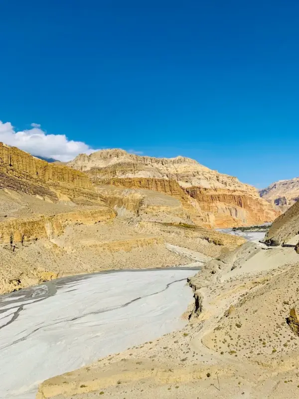
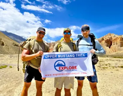
Trek Upper Mustang's Ancient Trails to Yara, Ghara, and Lo Manthang's Hidden Kingdom.
Upper Mustang Trek with Yara Ghara – 16 Days
Based on 60 reviews
A 16-day journey on the trail of Upper Mustang with Yara Ghara unfolds the side of the Himalaya that very few can see. It winds through the lush river valley to a dramatic, rain-shadow region and remote hidden villages. Each day takes you deeper into the cultural solitude of the ancient trade routes in between Nepal and Tibet. It deeply transforms your travel through time, terrain, and Himalayan heritages.

Duration
16 Days
Trip Difficulty
Difficult
Max Altitude:
4,298m. / 14,101ft.
Activity
Trekking
Group Size
1-10
Best Season
Autumn | Spring | Summer (Monsoon)
Meals
Breakfast, Lunch & Dinner (Mountain)
Accommodation
Hotel | Lodge | Guesthouse
Transportation
Private Vehicle | FlightOverview of Upper Mustang Trek with Yara Ghara – 16 Days
The 16-Day Upper Mustang Trek with Yara Ghara is an off-the-beaten-path trek extending into the rain-shadowed desert region of Nepal, Mustang. On this journey, you cross dramatic landscapes from the walled city of Lo-Manthang to sacred sites such as Ghar Gompa and the 13th-14th century Luri Gompa, with the overall trek spanning 140 Km – 150 Km.
Combining classic highlights of the ancient Kingdom of Lo with villages of Yara, Ghara, and Tangye, you pass through wind-swept sandstone cliffs, hand-carved caves, and a Tibetan-influenced culture. The highest point you reach on this trek is Marang La Pass (4,298m), which comes between Dhakmar and Lo Manthang. Atop the high passes, you get to enjoy panoramic mountain views of Dhaulagiri, Annapurna, and Nilgiri.
Traveling on this route feels like entering a different region with unique landscapes and ancient villages untouched by the modern world. It takes you to the medieval alleyways, century-old monasteries, caves, and historical trade routes. Apart from the natural beauty, the Yara Ghara extension allows you to have a deeper connection with the old Tibetan Buddhist traditions and the preserved heritage of the Loba people.
Difficulty of the Upper Mustang Trek with Yara Ghara
As our itinerary follows the eastern trail of Upper Mustang via Yara, Ghara, Tangye, and Tetang, it passes through moderate to strenuous terrain. Some of the difficulties that make it challenging are:
High Altitude Passes (above 4,000m): On this trek, you need to cross passes such as Marang La, Pa La, Mui La, and Gyu La Pass.
Long Walking Days: Some days, like Day 11, from Yara to Tangye (18.3 km) and Day 12, from Tangye to Tetang (28 km), are longer, with 7 to 8 hours.
Remote Trails with Limited Facilities: On the trail, there are sections, such as Tangye to Tetang, with no villages and water sources in between, likewise, Yara to Tangye Village, Tetang Village to Muktinath also requires a long day of walk in the altitude terrain. You must carry your own water and have good endurance.
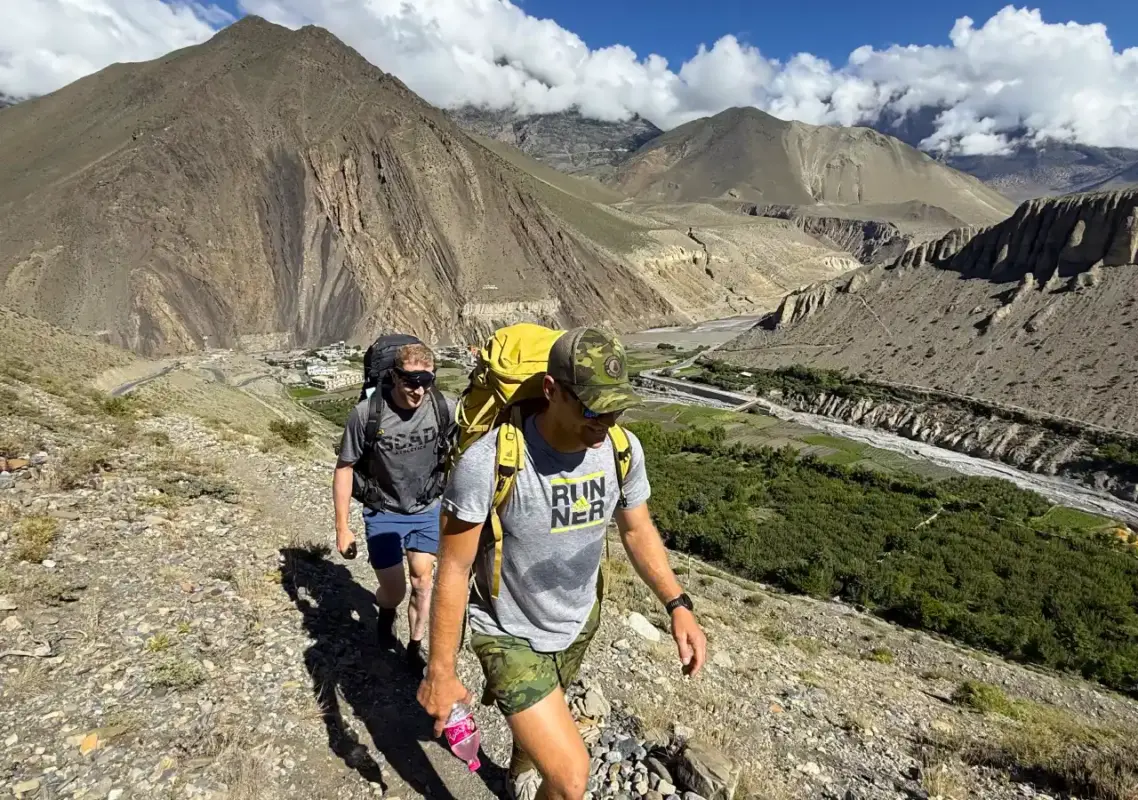
Windy Terrain: The Upper Mustang region has unique geography and a plateau-like landscape. As the region has minimal to no rainfall, it is dry and extremely windy, which can be irritating for some trekkers. To protect yourself from the wind and dust, gear must be chosen accordingly.
Who Is It For: It is ideal for trekkers with prior experience in multi-day trekking or who are prepared for the off-the-beaten-path. As the journey mainly focuses on cultural and heritage sites, it is also perfect for cultural enthusiasts.
Accommodation on the Upper Mustang Yara Ghara Trek Route
Along the trekking trail, except Kagbeni, Lo Manthang, and Muktinath, you stay at basic, simple teahouses. The rooms are twin-sharing, and above 3000m there are squat toilets except at Lo Manthang and Muktinath. Hot bucket showers and dining hall charging are mostly available at an extra charge.
Stop-By-Stop Accommodation According to Our Itinerary
Kagbeni: As a gateway to the Upper Mustang, there are standard teahouses, some with several decent options, with a solar shower, private and shared squat toilet.
Chele: Very basic and simple teahouses with shared toilets. You can get a gas geyser and bucket shower on request at an extra cost.
Syangboche: Basic high-altitude teahouses with simple twin rooms and shared toilets.
Dhakmar: It is a functional stop with basic but reliable teahouses. The rooms are simple, with twin-sharing rooms.
Lo Manthang: You can find one of the best lodges here in Upper Mustang with Yara Ghara journey. Both shared and attached bathrooms are available.
Yara: There are basic teahouses in the village with shared toilets and no attached baths. A bucket shower is available at an additional cost.
Tangye and Tetang: It is a peaceful stop with basic teahouses with simple rooms, a shared toilet, and no attached baths.
Muktinath: Here, you can find the best facilities after Lo Manthang. The teahouses are better, with better rooms and a mix of shared and attached bathrooms.
Alternative Treks to Upper Mustang with Yara Ghara
The Upper Mustang Yara Ghara Trek is one of the finest off the beaten treks in Nepal, taking you deep into the remote trails of the upper Mustang valley. If you are drawn to this kind of raw, less crowded trekking experience, here are a few other routes worth considering, in the Mustang region and beyond.
Classic Upper Mustang Trek, 13 Days
This is a shorter and easier alternative to the Yara Ghara route. It skips the remote villages of Yara and Tangye and instead follows the well-established trail: Kagbeni, Chele, Syangboche, Dhakmar, Lo Manthang, Chhusang, and Muktinath. With parts of the old trekking route now affected by motorable roads, we have adjusted this itinerary to keep it practical while still covering the highlights of the ancient Upper Mustang trail.
Kanchenjunga Circuit Trek, 22 Days
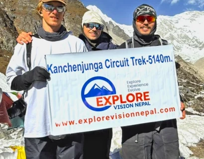
For trekkers wanting a bigger high altitude adventure, the Kanchenjunga Circuit is one of the least traveled off the beaten treks in eastern Nepal. It circles Mt. Kanchenjunga, the third highest mountain in the world, and combines dramatic mountain scenery with genuine cultural encounters along the way.
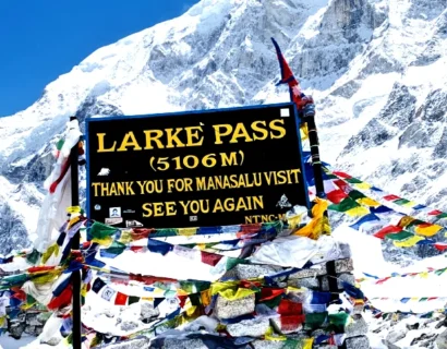
The Manaslu Circuit Trek is another excellent off the beaten path option, doable in about two weeks. The route takes you around Mount Manaslu, the eighth highest mountain in the world, and crosses the challenging Larke La Pass at 5,106 meters, making it a rewarding choice for trekkers who enjoy high mountain passes and remote trails. This trek can be the perfect alternative to the Upper Mustang with Yara Ghara trek.
Why choose Explore Vision Nepal for Upper Mustang Trek with Yara Ghara
A Practical, Well-Planned Itinerary: We have built this itinerary around years of walking these trails ourselves, not just off a map. Every day’s distance and altitude gain is planned with your comfort and acclimatization in mind, though on a remote high altitude route like this, day to day distances can shift slightly depending on trail and weather conditions.
The itinerary covers all the major highlights of the region, so you get the full experience of Upper Mustang and Yara Ghara, the dramatic desert like landscapes, ancient cave dwellings, remote villages rarely visited by outsiders, and the deep Tibetan Buddhist culture that defines this part of Nepal. We have also built in enough rest, exploration and acclimatization days to keep the trek safe at altitude, without unnecessary delays that stretch the trip longer than it needs to be. The result is an itinerary that’s realistic, well-paced, and designed to let you actually enjoy the trail rather than rush through it.
Local expertise and Experienced Guides: Rooted in Nepal, our team has deep local knowledge and highly experienced guides for the Upper Mustang Yara Ghara trail and knowledgeable about the Himalayas, Nepali culture and tradition.
Flexible and Customizable Plan Options: You can tailor your 16-day itinerary to your preferred rest days, side trips, and transport options with a hassle-free booking option.
Young and Customer-oriented Team: An energetic team dedicated to personal care, safety, and seamless support from arrival to departure.
Logistical Service and transit handling in the package: Upper Mustang requires a Restricted Area Permit, a mandatory licensed guide, and ACAP permits. We manage all permits and arrange reliable transport throughout the journey.
Complimentary Trekking Gear and Benefits: Down jacket and sleeping bag (for trekking days), company T-shirt and duffle bag, trekking map of the Upper Mustang route, and Trip completion certificate.


Outline Itinerary of Upper Mustang Trek with Yara Ghara – 16 Days
Day 01: Arrive at Tribhuvan International Airport Kathmandu, Nepal (1,350M/4,430Ft)
Day 02: Drive from Kathmandu to Pokhara (822M/2,700 Ft), Distance: 200 Km, Duration: 6-7 Hours
Day 03: Drive from Pokhara to Kagbeni Village (2,804M/9,200Ft), Distance: 155 km, Duration: 6 Hours
Day 04: Trek from Kagbeni to Chele (3,050M/10,006Ft), Distance: 13 km, Duration: 6 Hours
Day 05: Trek from Chele to Syangboche (3,800M/12,465Ft), Distance: 13-14 Km, Duration: 7 Hours
Day 06: Trek from Syangboche to Dhakmar (3,820M/12,530Ft), Distance: 18 km, Duration: 7-8 Hours
Day 07: Trek from Dhakmar to Lo-Manthang (3,810M/12,500Ft) Via Ghar Gumba (3,950M/12,960Ft), Distance: 17 Km, Duration: 7-8 Hours
Day 08: Lo-Manthang Exploration Day, Visit Chhoser Cave and Local Monastery
Day 09: Trek from Lo-Manthang to Yara (3,607M/11,830Ft), Distance: 17 Km, Duration: 7 Hours
Day 10: Cultural Exploration to Luri Gompa (3,900m) & Return, Distance: 7-8 Km, Duration: 6-7 Hours
Day 11: Trek from Yara to Tangye Village (3,240M/10,627Ft)), Distance: 18 Km, Duration: 7-8 Hours
Day 12: Trek from Tangye to Tetang (3,067M/10,060Ft), Distance: Approx. 25 Km Duration: 8-10 Hours
Day 13: Trek from Tetang Village to Muktinath (3,800M/12,465Ft) via the Gyu La Pass (4,077m), Distance: 15 Km, Duration: 7-8 Hours
Day 14: Drive from Muktinath to Pokhara (822M/2,700 Ft), Distance: 170 Km, Duration: 6-7 Hours
Day 15: Flight from Pokhara to Kathmandu, Duration: 30 Minutes
Day 16: Farewell | Departure
Trip Highlights
- Visit one of the oldest Nyingma monasteries in Mustang, Ghar Gumba, and an ancient cave monastery with preserved Buddhist wall paintings and chortens, Luri Gompa.
- Enjoy scenic mountain views of Nilgiri, Dhaulagiri, Annapurna, and Damodar Himal ranges along the trail.
- Cross high-altitude passes: Chogo La/Marang La, Gyula Pass, Nyila Pass, Mui La Pass
- Travel through the dramatic gorges of the Kali Gandaki (deepest gorge) and Puyung Khola river basins.
- Explore the historic walled city of Lo-Manthang and nearby wall caves of Chhoser.
- Take visits to centuries-old gompas including Jhampa, Thupchen, and Choede in Lo Manthang.
- Explore the traditional settlements Yara, Ghara, and Tangye with mud-brick houses and barley fields.
- Experience authentic cultures and hospitality with the local Loba people on the journey.
- Discover the dramatic red sandstone cliffs of Dhakmar.
- Walk through plateau-like landscapes, desert canyons, and Trans Himalayan beauty.
- Visit Muktinath via high passes, an important religious site for both Hindus and Buddhists with 108 holy water sprouts and an infinite flame.
Itinerary Overview of Upper Mustang Trek with Yara Ghara – 16 Days
The journey begins with a drive from Kathmandu to Pokhara, through Kali Gandaki Gorge to Kagbeni. From there you trek to the high-altitude landscapes ascending to Chele, Syangboche, and Dhakmar to reach the ancient walled city of Lo-Manthang. There you explore local monasteries and the multi-story Chhoser Caves.
Following the route, you cross the remote eastern villages of Yara, serving as a base to visit the 13th-century cliffside cave monastery of Luri Gompa and Ghara village. Then it continues through Tangye and Tetang, climbing to the sacred pilgrimage site of Muktinath. Then, finally, complete your Upper Mustang Journey via Yara Ghara, with a drive back to Pokhara, followed by a flight to Kathmandu.
Upper Mustang Trek with Yara Ghara – 16 Days Itinerary
01
Day 01: Arrive at Tribhuvan International Airport Kathmandu, Nepal (1,350M/4,430Ft)
Welcome to the country of the Himalayas! As you land at the airport and get off, you can feel a sensation of thrill, excitement, and energy. Our representative waits for your arrival with a warm heart and an EVN postcard in hand. Then, you are transferred to your hotel.
After check in to the hotel, we will have a trip meeting together, we provides you with brief information about the trip. You are free to ask any questions and discuss the trip expectations. At the same time, we provides you some gear for the trip from the company side, like Duffel Bag, Sleeping Bag, Down Jacket, Trekking Map etc., then Unpack your luggage, freshen up, and take a rest!

Activity: Drive

Max. Altitude: 1,350m/4,429ft. (Kathmandu )

Accommodation: Hotel
02
Day 02: Drive from Kathmandu to Pokhara (822M/2,700 Ft), Distance: 200 Km, Duration: 6-7 Hours
After breakfast in the morning, you begin your scenic drive along Prithvi Highway by comfortable tourist bus, descending along the Trishuli River before following the Marshyangdi River. On the ride, you can see the landscape change from the central hills to terraced farming villages and lush forests.
Then, passing through bustling markets and local town such as Malekhu, Mugling, and Dumre, you reach Pokhara. The rest of the evening you can spend time relaxing beside Fewa Lake.
Activity: Drive
Max. Altitude: 822m/2,697ft. (Pokhara)

Meal: Breakfast
Accommodation: Hotel
03
Day 03: Drive from Pokhara to Kagbeni Village (2,804M/9,200Ft), Distance: 155 km, Duration: 6 Hours
Leaving the city behind, the drive heads northwest from Pokhara toward Nayapul and Kusma. Then starts to follow the Kali Gandaki River through Beni. Then the off-road starts, passing through Tatopani, Marpha, and Jomsom to Kagbeni.
It is also known as the official gateway to the Upper Mustang region, where ACAP and Restricted Area permits are checked before you enter.
Activity: Drive
Max. Altitude: 2,804m/9,199ft. (Kagbeni )
Meal: Breakfast, Lunch, Dinner
Accommodation: Guesthouse
04
Day 04: Trek from Kagbeni to Chele (3,050M/10,006Ft), Distance: 13 km, Duration: 6 Hours
The trek starts from Kagbeni, you head north along the Kali Gandaki Valley. It has a mix of motorable roads. You begin with a gentle descent along the barley, wheat, and buckwheat farms near the village named Tangbe. This is a small Mustangi settlement with stone houses. On the way, you can get distant views of Nilgiri, Dhaulagiri, and Annapurna mountain range on clear days.
Then, climbing across the valley, you reach Tetang. After that, the trail descends toward a river and climbs again to a village named Chhusang village. From the village you can look up the valley towards Chele and beyond.
In the last section, you take a long final climb along the canyon walls reaching Chele. It is a beautiful village set dramatically above the river, surrounded by the red and ochre cliffs
Activity: Trekking
Max. Altitude: 3,056m/10,026ft. (Chele)
Meal: Breakfast, Lunch, Dinner
Accommodation: Guesthouse
05
Day 05: Trek from Chele to Syangboche (3,800M/12,465Ft), Distance: 13-14 Km, Duration: 7 Hours
Starting the trek from Chele, you climb steeply out of the village following the desert landscape with views of cliffs, rugged slopes, and bareness. It passes through narrow pathways with rocky steps and steep descents. On this day, you cross two passes: Taklam La and then Dajori La, the day might feel longer.
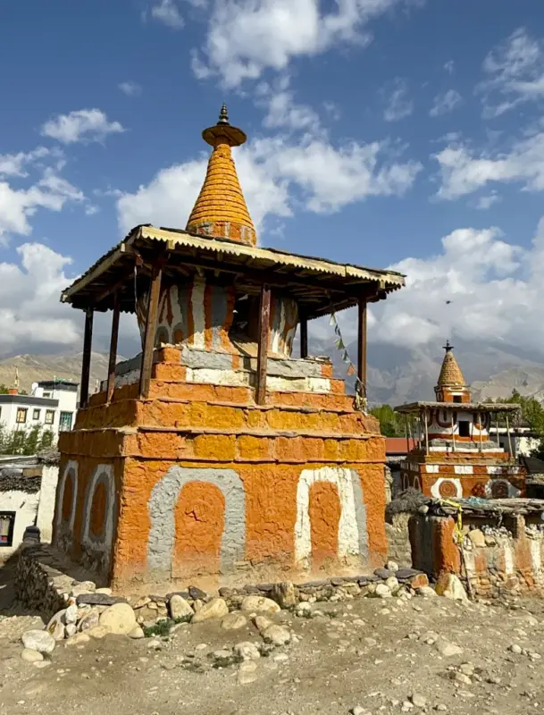
It begins with the crossing of Taklam La Pass, from where you get glimpses of Nilgiri, Tilicho Peak, Yakawa Kang, and Damodar Danda. After that, it goes down to Samar village before the next pass. The entrance before Samar has Rigsum Gonpo (three-tiered stone chortens with prayer flags), a very important cultural landmark.
Enjoying the views of Nilgiri from the village, the trail continues to the next pass, Dajo Ri La. Crossing it, you descend to the small village of Syangboche, last stop of the day.
Activity: Trekking
Max. Altitude: 3,800m/12,467ft. (Syangboche)
Meal: Breakfast, Lunch, Dinner
Accommodation: Guesthouse
06
Day 06: Trek from Syangboche to Dhakmar (3,820M/12,530Ft), Distance: 18 km, Duration: 7-8 Hours
Diving deeper into the plateau-like landscapes of Upper Mustang, you take gentle climbs and descents reaching Tama Gaun. You can see the stunning views surrounding Mustang ridges and distant peaks from here.
Passing Tama Gaun, you cross Nyi La Pass, rewarding you with breathtaking mountain views of Annapurna (8,091m), the three peaks of Dhaulagiri (8,167m), and Nilgiri (7,061m). Then you descend to Ghami Village (3,510m), the third-largest village of the Upper Mustang region.
Likewise, you continue along the up-and-down trails with rocky sections, crossing Ghami Khola, you reach Dhakmar. It is a remote and peaceful village with few teahouses and farms, with red-stained cliffs by the side.
Activity: Trekking
Max. Altitude: 3,820m/12,533ft. (Dhakmar)
Meal: Breakfast, Lunch, Dinner
Accommodation: Guesthouse
07
Day 07: Trek from Dhakmar to Lo-Manthang (3,810M/12,500Ft) Via Ghar Gumba (3,950M/12,960Ft), Distance: 17 Km, Duration: 7-8 Hours
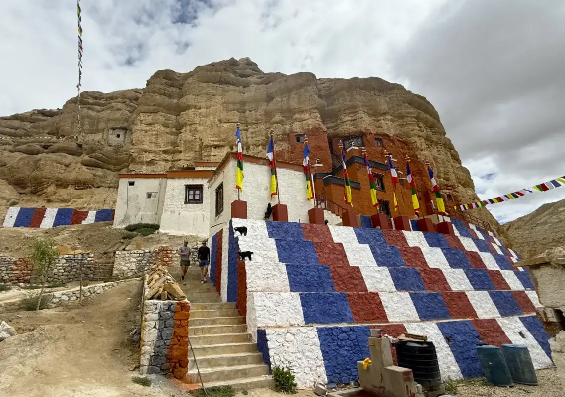
Today, the day starts with a wide, open, and barren landscape. You head west, following the path over low ridges and side valleys. On the way, you cross Muila Pass (4,170m) and reach Ghar Gompa or Ghar Gomba, one of the oldest monasteries in Mustang. It is traditionally known to have a link to Guru Rinpoche, dating back to the 8th century. This adds depth to your cultural experience on this trail. From the village, you get to witness stunning mountain views of Annapurna and Dhaulagiri.
After that, you climb to Chogo La or Marang La Pass (4,298m), then descend toward Tsarang Valley, finally approaching Lo Manthang. On the way, you get to witness a wider view of Mt, Annapurna, Nilgiri, and Dhaulagiri.
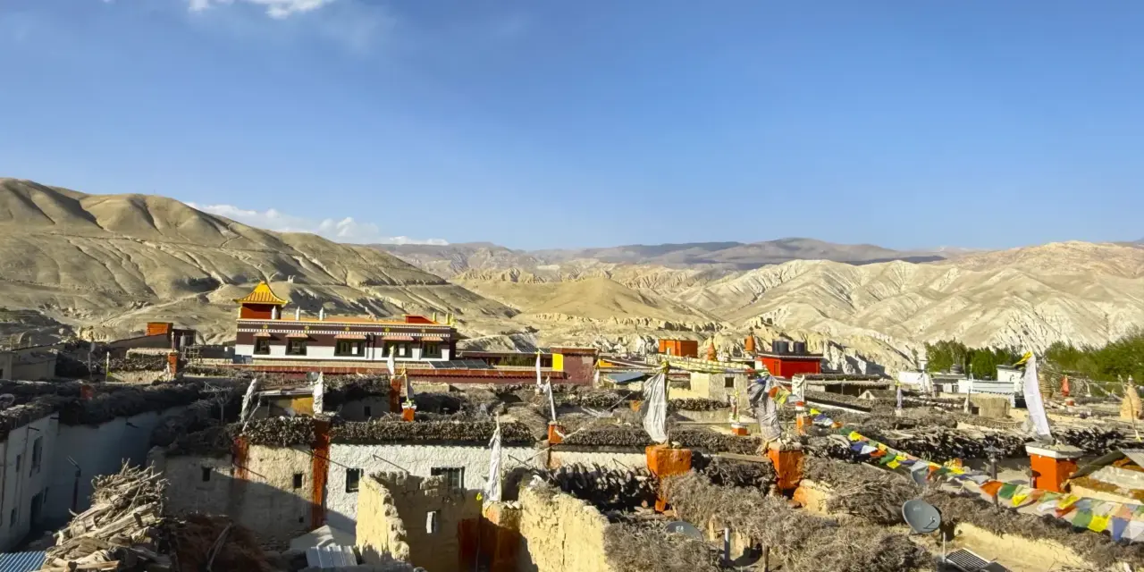
As you near the village, you get the first classic view of the walled city. You get to witness the whitewashed houses, red monastery walls, and prayer flags. The atmosphere reaching the village feels more like entering a medieval region.
Activity: Trekking
Max. Altitude: 3,810m/12,500ft. (Lo Manthang )
Meal: Breakfast, Lunch, Dinner
Accommodation: Guesthouse
08
Day 08: Lo-Manthang Exploration Day, Visit Chhoser Cave and Local Monastery
This is your exploration day in Lo Manthang, the former capital of the Kingdom of Lo. You start by exploring the local monasteries of Lo. You visit Thubchen Gompa, the largest and most important monastery. Jampa (Champa) Gompa, a three-storey temple with a large statue of Maitreya Buddha and old wall paintings. And Chode Gompa/Raja’s palace, a royal palace area with courtyards and religious arts.
Then from there, you take a half-day trip to the Chhoser sky caves by ride. Then you follow up to the base of the cliff with sky caves. Then, walking through a gravel path, you step near the caves and explore. These are man-made caves carved into the cliffs dating back 2,000 to 3,000 years, 50 meters from the ground, some used as storage and meditation halls. Some caves are accessed with internal passage or by ladders. Completing the trip, you return to Lo Manthang.
Activity: Day Tour
Max. Altitude: 3,810m/12,500ft. (Lo Manthang )
Meal: Breakfast, Lunch, Dinner
Accommodation: Guesthouse
09
Day 09: Trek from Lo-Manthang to Yara (3,607M/11,830Ft), Distance: 17 Km, Duration: 7 Hours
Leaving Lo, you pass the Sungda Chorten, a large chorten on the ridge. Then, turning to the east, you walk toward the Dhi valley. You can look back at the views of Lo Manthang city. Then, you climb up to the Lo La Pass, marked with prayer flags. From the pass, you get wide views of the valley.
Descending from there, you come over a small ridge, Dhi La, from where the steep descent to Dhi Gaon begins. It is one of the dramatic sections of the day. From there you follow the lower terraces of the Puyung Khola, passing Surkhang. Then you take a last climb to the small village of Yara located at 3,607 meters in the less traveled region of the upper mustang, Nepal.
Activity: Trekking
Max. Altitude: 3,607m/11,834ft. (Yara Village )
Meal: Breakfast, Lunch, Dinner
Accommodation: Guesthouse
10
Day 10: Cultural Exploration to Luri Gompa (3,900m) & Return, Distance: 7-8 Km, Duration: 6-7 Hours
Today you take a half-day hike to Ghara village and Luri Gompa located at 3,900 meters. It begins with the north trail up a narrow route carved by Puyung Khola to Ghara. It is an ancient traditional Loba village with mud-brick houses and historic polyandrous community structures. Also, another amazing highlight of the village is its breathtaking views of red canyons toward Mount Dhaulagiri.
From Ghara, you descend to Luri Gompa. Luri consists of two monasteries, one built at the base of the cliffs, and the other, a 13th and 14th-century important monastery with historical paintings, statues, and a cave meditation chamber. These are the hidden marks left by early Tibetan Buddhism and Guru Rinporche.
Before returning to Yara, you can take a short optional detour to Tashi Kabum (30 to 45 minutes). It is another carved cave chamber with rare ancient paintings and chortens.
Completing the exploration, you take a direct trail through Puyung Khola stream leading back to Yara.
Activity: Hiking | Exploration
Max. Altitude: 3,607m/11,834ft. (Yara-Ghara-Luri-Yara)
Meal: Breakfast, Lunch, Dinner
Accommodation: Guesthouse
11
Day 11: Trek from Yara to Tangye Village (3,240M/10,627Ft)), Distance: 18 Km, Duration: 7-8 Hours
The trek today from Yara village to Tangye village is long. Leaving Yara, you head south down to cross the Dhechyang Khola river. Then, climb up a steep side valley leading to Pa La pass (4,160m). From the top, enjoy stunning views of Damodar Himal and the surrounding plateau.
After that, you take a long, steep descent around the red cliffs and Ghechyang River Valley to Tangye village, located at 3,240 meters. It is a tiring but scenic part of the journey. Reaching the village, you can witness its beautiful, distinctive rows of chortens and mud-brick walls.
Activity: Trekking
Max. Altitude: 3,240m/10,630ft. (Tangye Village)
Meal: Breakfast, Lunch, Dinner
Accommodation: Guesthouse
12
Day 12: Trek from Tangye to Tetang (3,067M/10,060Ft), Distance: Approx. 25 Km Duration: 8-10 Hours
This is the longest and most remote part of the Upper Mustang Yara Ghar journey; the trail climbs 1,100m from Tangye, dropping to 1,150m at Tetang. Leaving Tangye, you come across a suspension bridge leading you to Yak Khola. Then, the route ascends through an arid path to reach Paha High Pass (4,210m). From that point, you get beautiful views of Damodar Mountain and Saribung peak.
For about 4 to 5 hours, the stretch between Tangye and Paha has no villages or water sources. So, we suggest you carry at least 3 liters of water.
The landscape gets increasingly arid and desert-like. You continue on the trails of Puyung Khola/Kali Gandaki, then crossing several ups and downs, you reach Tetang village, located at the elevation of 3,067 meters.
Activity: Trekking
Max. Altitude: 3,067m/10,062ft. (Tetang Village )
Meal: Breakfast, Lunch, Dinner
Accommodation: Guesthouse
13
Day 13: Trek from Tetang Village to Muktinath (3,800M/12,465Ft) via the Gyu La Pass (4,077m), Distance: 15 Km, Duration: 7-8 Hours
Today you begin trekking from Tetang to Muktinath about 15 kilometers via the Gyu La Pass (4,077m), the highest point you reach on the day. The climb to this pass is steep and has windy ridges. From that point, you have stunning 360-degree panoramic views of Mount Dhaulagiri, Annapurna I, Nilgiri, Thorong Peak, Mt. Tukuche, and the Jhong River valley.
After that, you take a long, steep descent through the villages of Chhenkur and Jharkot into the Kali Gandaki valley to Muktinath. It is a pilgrimage site mixed with Hindu and Buddhist temples and a home to 108 water sprouts and an eternal flame.
Activity: Trekking
Max. Altitude: 3,800m/12,467ft. (Muktinath)
Meal: Breakfast, Lunch, Dinner
Accommodation: Guesthouse
14
Day 14: Drive from Muktinath to Pokhara (822M/2,700 Ft), Distance: 170 Km, Duration: 6-7 Hours
After spending about 10 days in the Mustang Region, you will leave it today and drive towards Pokhara. The drive starts with a descent through Kali Gandaki Gorge. It passes through Jomsom, Marpha, Tatopani and Beni. The journey changes from rough roads to the smooth highway after Beni until the lakeside city of Pokhara.
Activity: Drive
Max. Altitude: 822m/2,697ft. (Pokhara)
Meal: Breakfast, Lunch
Accommodation: Hotel
15
Day 15: Flight from Pokhara to Kathmandu, Duration: 30 Minutes
Your 16-Day Upper Mustang trek with Yara Ghara ends with a short flight back to Kathmandu. During the flight, you might as well enjoy the stunning top views of Annapurna, Manaslu, and Langtang mountain ranges.
Activity: Flight
Max. Altitude: 1,350m/4,429ft. (Kathmandu )
Meal: Breakfast
Accommodation: Hotel
16
Day 16: Farewell | Departure
For the air transfer, your guide or a representative from our team picks you up at the hotel. Then, drop you off 3 hours before the scheduled flight. Catch the final glimpses of Kathmandu alleys, stupas, temples, and prayer wheels on the drive.
At the airport, our representative provides a short farewell section with a see you next time!
Activity: Drive
Max. Altitude: 1,350m/4,429ft. (Kathmandu)
Meal: Breakfast

Note:
If you have a private group and prefer a personalized experience, we can organize a custom trip tailored to your requirements and group size, running it any day you choose.
Price Includes


Price Excludes

What's included?
- Airport Transfers: Arrival and departure transfers between the airport and hotel by private vehicle.
- Kathmandu Accommodation: 2 nights at a comfortable 3-star category hotel in Kathmandu, including breakfast.
- Pokhara Accommodation: 2 nights at a 3-star category hotel in Pokhara with breakfast.
- Meals During the Trek: Full-board meals throughout the trek, including breakfast, lunch, dinner, and tea or coffee.
- Trekking Accommodation: Best available local teahouse and lodge accommodation on a twin-sharing basis throughout the trekking route.
- Kathmandu–Pokhara Transportation: Tourist bus transportation from Kathmandu to Pokhara.
- Pokhara–Kathmandu Flight: Domestic flight from Pokhara to Kathmandu at the end of the trip.
- Private Jeep Transportation: Private 4WD jeep transportation from Pokhara to Kagbeni and from Muktinath to Pokhara as specified in the itinerary.
- Experienced Trekking Guide: A government-licensed, experienced, and English-speaking trekking guide throughout the journey.
- Porter Service: One porter for every two trekkers to carry the group’s trekking duffel bags.
- Trekking Staff Services: All costs related to the trekking team, including their wages, meals, accommodation, transportation, required equipment, and accidental insurance.
- Upper Mustang Restricted Area Permit: All required fees for the Upper Mustang Restricted Area Permit (RAP).
- Annapurna Conservation Area Permit: Annapurna Conservation Area Permit (ACAP) and applicable conservation fees.
- Local Permits and Documentation: All necessary local government permits and trekking-related paperwork.
- Cultural and Heritage Site Fees: Entrance fees for monasteries, temples, and cultural heritage sites specifically included in the itinerary, particularly around Lo Manthang.
- Trekking Equipment: Sleeping bag and down jacket provided for use during the trek.
- Seasonal Fresh Fruit: Fresh seasonal fruit served during the trekking journey.
- First Aid Support: A comprehensive first-aid kit carried by the trekking guide.
- Trek Completion Certificate: Official Explore Vision Nepal trekking completion certificate upon successful completion of the trek.
- Government Taxes and Service Charges: All applicable government taxes and company service charges.
What's not included?
- International airfare to and from Nepal.
- Nepal entry visa and related visa fees.
- Lunch and dinner in Kathmandu, Pokhara and Highway
- Travel insurance, including medical treatment and emergency evacuation coverage.
- Personal trekking clothing, footwear, and equipment not specifically listed under the inclusions.
- Personal expenses such as bottled water, soft drinks, alcoholic beverages, snacks, hot showers, Wi-Fi/internet, battery charging, laundry, and telephone calls.
- Any additional expenses caused by flight delays or cancellations, road blockages, bad weather, illness, early return, or other unforeseen circumstances beyond our control.
- Additional accommodation, meals, transportation, or other services required beyond the services specified in the itinerary.
- Tips and gratuities for the trekking guide, porters, drivers, and other support staff. Tipping is entirely at your discretion but is highly appreciated.
Departure Dates
Start Date
11 Oct 2026End Date
27 Oct 2026Price
US$ 1890
 Guaranteed
Start Date
14 Oct 2026End Date
30 Oct 2026Price
US$ 1890
Guaranteed
Start Date
15 Oct 2026End Date
31 Oct 2026Price
US$ 1890
Guaranteed
Start Date
18 Oct 2026End Date
03 Nov 2026Price
US$ 1890
Guaranteed
Start Date
19 Oct 2026End Date
04 Nov 2026Price
US$ 1890
Guaranteed
Start Date
20 Oct 2026End Date
05 Nov 2026Price
US$ 1890
Guaranteed
Start Date
23 Oct 2026End Date
08 Nov 2026Price
US$ 1890
Guaranteed
Start Date
24 Oct 2026End Date
09 Nov 2026Price
US$ 1890
Guaranteed
Start Date
25 Oct 2026End Date
10 Nov 2026Price
US$ 1890
Guaranteed
Start Date
27 Oct 2026End Date
12 Nov 2026Price
US$ 1890
Guaranteed
Start Date
29 Oct 2026End Date
14 Nov 2026Price
US$ 1890
Guaranteed
Start Date
30 Oct 2026End Date
15 Nov 2026Price
US$ 1890
Guaranteed
Start Date
01 Nov 2026End Date
17 Nov 2026Price
US$ 1890
Guaranteed
Start Date
02 Nov 2026End Date
18 Nov 2026Price
US$ 1890
Guaranteed
Start Date
03 Nov 2026End Date
19 Nov 2026Price
US$ 1890
Guaranteed
Start Date
05 Nov 2026End Date
21 Nov 2026Price
US$ 1890
Guaranteed
Start Date
06 Nov 2026End Date
22 Nov 2026Price
US$ 1890
Guaranteed
Start Date
09 Nov 2026End Date
25 Nov 2026Price
US$ 1890
Guaranteed
Start Date
10 Nov 2026End Date
26 Nov 2026Price
US$ 1890
Guaranteed
Start Date
11 Nov 2026End Date
27 Nov 2026Price
US$ 1890
Guaranteed
Start Date
14 Nov 2026End Date
30 Nov 2026Price
US$ 1890
Guaranteed
Start Date
17 Nov 2026End Date
03 Dec 2026Price
US$ 1890
Guaranteed
Start Date
18 Nov 2026End Date
04 Dec 2026Price
US$ 1890
Guaranteed
Start Date
19 Nov 2026End Date
05 Dec 2026Price
US$ 1890
Guaranteed
Start Date
22 Nov 2026End Date
08 Dec 2026Price
US$ 1890
Guaranteed
Start Date
23 Nov 2026End Date
09 Dec 2026Price
US$ 1890
Guaranteed
Start Date
26 Nov 2026End Date
12 Dec 2026Price
US$ 1890
Guaranteed
Start Date
27 Nov 2026End Date
13 Dec 2026Price
US$ 1890
Guaranteed
Start Date
28 Nov 2026End Date
14 Dec 2026Price
US$ 1890
Guaranteed
Start Date
05 Dec 2026End Date
21 Dec 2026Price
US$ 1890
Guaranteed
Start Date
06 Dec 2026End Date
22 Dec 2026Price
US$ 1890
Guaranteed
Start Date
07 Dec 2026End Date
23 Dec 2026Price
US$ 1890
Guaranteed
Start Date
10 Dec 2026End Date
26 Dec 2026Price
US$ 1890
Guaranteed
Start Date
11 Dec 2026End Date
27 Dec 2026Price
US$ 1890
Guaranteed
Start Date
14 Dec 2026End Date
30 Dec 2026Price
US$ 1890
Guaranteed
Start Date
17 Dec 2026End Date
02 Jan 2027Price
US$ 1890
Guaranteed
Start Date
18 Dec 2026End Date
03 Jan 2027Price
US$ 1890
Guaranteed
Start Date
19 Dec 2026End Date
04 Jan 2027Price
US$ 1890
Guaranteed
Start Date
22 Dec 2026End Date
07 Jan 2027Price
US$ 1890
Guaranteed
Start Date
23 Dec 2026End Date
08 Jan 2027Price
US$ 1890
Guaranteed
Start Date
27 Dec 2026End Date
12 Jan 2027Price
US$ 1890
Guaranteed
Start Date
28 Dec 2026End Date
13 Jan 2027Price
US$ 1890
Guaranteed
Start Date
29 Dec 2026End Date
14 Jan 2027Price
US$ 1890
Guaranteed
Start Date
30 Dec 2026End Date
15 Jan 2027Price
US$ 1890
Guaranteed
Start Date
02 Jan 2027End Date
18 Jan 2027Price
US$ 1890
Guaranteed
Start Date
03 Jan 2027End Date
19 Jan 2027Price
US$ 1890
Guaranteed
Start Date
06 Jan 2027End Date
22 Jan 2027Price
US$ 1890
Guaranteed
Start Date
07 Jan 2027End Date
23 Jan 2027Price
US$ 1890
Guaranteed
Start Date
11 Jan 2027End Date
27 Jan 2027Price
US$ 1890
Guaranteed
Start Date
12 Jan 2027End Date
28 Jan 2027Price
US$ 1890
Guaranteed
Start Date
15 Jan 2027End Date
31 Jan 2027Price
US$ 1890
Guaranteed
Start Date
17 Jan 2027End Date
02 Feb 2027Price
US$ 1890
Guaranteed
Start Date
18 Jan 2027End Date
03 Feb 2027Price
US$ 1890
Guaranteed
Start Date
19 Jan 2027End Date
04 Feb 2027Price
US$ 1890
Guaranteed
Start Date
23 Jan 2027End Date
08 Feb 2027Price
US$ 1890
Guaranteed
Start Date
26 Jan 2027End Date
11 Feb 2027Price
US$ 1890
Guaranteed
Start Date
27 Jan 2027End Date
12 Feb 2027Price
US$ 1890
Guaranteed
Start Date
28 Jan 2027End Date
13 Feb 2027Price
US$ 1890
Guaranteed
Start Date
01 Feb 2027End Date
17 Feb 2027Price
US$ 1890
Guaranteed
Start Date
02 Feb 2027End Date
18 Feb 2027Price
US$ 1890
Guaranteed
Start Date
03 Feb 2027End Date
19 Feb 2027Price
US$ 1890
Guaranteed
Start Date
05 Feb 2027End Date
21 Feb 2027Price
US$ 1890
Guaranteed
Start Date
08 Feb 2027End Date
24 Feb 2027Price
US$ 1890
Guaranteed
Start Date
09 Feb 2027End Date
25 Feb 2027Price
US$ 1890
Guaranteed
Start Date
10 Feb 2027End Date
26 Feb 2027Price
US$ 1890
Guaranteed
Start Date
11 Feb 2027End Date
27 Feb 2027Price
US$ 1890
Guaranteed
Start Date
12 Feb 2027End Date
28 Feb 2027Price
US$ 1890
Guaranteed
Start Date
12 Feb 2027End Date
28 Feb 2027Price
US$ 1890
Guaranteed
Start Date
13 Feb 2027End Date
01 Mar 2027Price
US$ 1890
Guaranteed
Start Date
14 Feb 2027End Date
02 Mar 2027Price
US$ 1890
Guaranteed
Start Date
15 Feb 2027End Date
03 Mar 2027Price
US$ 1890
Guaranteed
Start Date
16 Feb 2027End Date
04 Mar 2027Price
US$ 1890
Guaranteed
Start Date
16 Feb 2027End Date
04 Mar 2027Price
US$ 1890
Guaranteed
Start Date
17 Feb 2027End Date
05 Mar 2027Price
US$ 1890
Guaranteed
Start Date
17 Feb 2027End Date
05 Mar 2027Price
US$ 1890
Guaranteed
Start Date
18 Feb 2027End Date
06 Mar 2027Price
US$ 1890
Guaranteed
Start Date
19 Feb 2027End Date
07 Mar 2027Price
US$ 1890
Guaranteed
Start Date
19 Feb 2027End Date
07 Mar 2027Price
US$ 1890
Guaranteed
Start Date
20 Feb 2027End Date
08 Mar 2027Price
US$ 1890
Guaranteed
Start Date
20 Feb 2027End Date
08 Mar 2027Price
US$ 1890
Guaranteed
Start Date
21 Feb 2027End Date
09 Mar 2027Price
US$ 1890
Guaranteed
Start Date
22 Feb 2027End Date
10 Mar 2027Price
US$ 1890
Guaranteed
Start Date
23 Feb 2027End Date
11 Mar 2027Price
US$ 1890
Guaranteed
Start Date
23 Feb 2027End Date
11 Mar 2027Price
US$ 1890
Guaranteed
Start Date
24 Feb 2027End Date
12 Mar 2027Price
US$ 1890
Guaranteed
Start Date
24 Feb 2027End Date
12 Mar 2027Price
US$ 1890
Guaranteed
Start Date
25 Feb 2027End Date
13 Mar 2027Price
US$ 1890
Guaranteed
Start Date
26 Feb 2027End Date
14 Mar 2027Price
US$ 1890
Guaranteed
Start Date
26 Feb 2027End Date
14 Mar 2027Price
US$ 1890
Guaranteed
Start Date
27 Feb 2027End Date
15 Mar 2027Price
US$ 1890
Guaranteed
Start Date
27 Feb 2027End Date
15 Mar 2027Price
US$ 1890
Guaranteed
Start Date
28 Feb 2027End Date
16 Mar 2027Price
US$ 1890
Guaranteed
Start Date
01 Mar 2027End Date
17 Mar 2027Price
US$ 1890
Guaranteed
Start Date
02 Mar 2027End Date
18 Mar 2027Price
US$ 1890
Guaranteed
Start Date
03 Mar 2027End Date
19 Mar 2027Price
US$ 1890
Guaranteed
Start Date
04 Mar 2027End Date
20 Mar 2027Price
US$ 1890
Guaranteed
Start Date
05 Mar 2027End Date
21 Mar 2027Price
US$ 1890
Guaranteed
Start Date
06 Mar 2027End Date
22 Mar 2027Price
US$ 1890
Guaranteed
Start Date
07 Mar 2027End Date
23 Mar 2027Price
US$ 1890
Guaranteed
Start Date
08 Mar 2027End Date
24 Mar 2027Price
US$ 1890
Guaranteed
Start Date
09 Mar 2027End Date
25 Mar 2027Price
US$ 1890
Guaranteed
Start Date
10 Mar 2027End Date
26 Mar 2027Price
US$ 1890
Guaranteed
Start Date
11 Mar 2027End Date
27 Mar 2027Price
US$ 1890
Guaranteed
Start Date
12 Mar 2027End Date
28 Mar 2027Price
US$ 1890
Guaranteed
Start Date
13 Mar 2027End Date
29 Mar 2027Price
US$ 1890
Guaranteed
Start Date
14 Mar 2027End Date
30 Mar 2027Price
US$ 1890
Guaranteed
Start Date
15 Mar 2027End Date
31 Mar 2027Price
US$ 1890
Guaranteed
Start Date
16 Mar 2027End Date
01 Apr 2027Price
US$ 1890
Guaranteed
Start Date
17 Mar 2027End Date
02 Apr 2027Price
US$ 1890
Guaranteed
Start Date
18 Mar 2027End Date
03 Apr 2027Price
US$ 1890
Guaranteed
Start Date
19 Mar 2027End Date
04 Apr 2027Price
US$ 1890
Guaranteed
Start Date
20 Mar 2027End Date
05 Apr 2027Price
US$ 1890
Guaranteed
Start Date
21 Mar 2027End Date
06 Apr 2027Price
US$ 1890
Guaranteed
Start Date
22 Mar 2027End Date
07 Apr 2027Price
US$ 1890
Guaranteed
Start Date
23 Mar 2027End Date
08 Apr 2027Price
US$ 1890
Guaranteed
Start Date
24 Mar 2027End Date
09 Apr 2027Price
US$ 1890
Guaranteed
Start Date
25 Mar 2027End Date
10 Apr 2027Price
US$ 1890
Guaranteed
Start Date
26 Mar 2027End Date
11 Apr 2027Price
US$ 1890
Guaranteed
Start Date
27 Mar 2027End Date
12 Apr 2027Price
US$ 1890
Guaranteed
Start Date
28 Mar 2027End Date
13 Apr 2027Price
US$ 1890
Guaranteed
Start Date
29 Mar 2027End Date
14 Apr 2027Price
US$ 1890
Guaranteed
Start Date
30 Mar 2027End Date
15 Apr 2027Price
US$ 1890
Guaranteed
Start Date
31 Mar 2027End Date
16 Apr 2027Price
US$ 1890
Guaranteed
Start Date
01 Apr 2027End Date
17 Apr 2027Price
US$ 1890
Guaranteed
Start Date
02 Apr 2027End Date
18 Apr 2027Price
US$ 1890
Guaranteed
Start Date
03 Apr 2027End Date
19 Apr 2027Price
US$ 1890
Guaranteed
Start Date
04 Apr 2027End Date
20 Apr 2027Price
US$ 1890
Guaranteed
Start Date
05 Apr 2027End Date
21 Apr 2027Price
US$ 1890
Guaranteed
Start Date
06 Apr 2027End Date
22 Apr 2027Price
US$ 1890
Guaranteed
Start Date
07 Apr 2027End Date
23 Apr 2027Price
US$ 1890
Guaranteed
Start Date
08 Apr 2027End Date
24 Apr 2027Price
US$ 1890
Guaranteed
Start Date
09 Apr 2027End Date
25 Apr 2027Price
US$ 1890
Guaranteed
Start Date
10 Apr 2027End Date
26 Apr 2027Price
US$ 1890
Guaranteed
Start Date
11 Apr 2027End Date
27 Apr 2027Price
US$ 1890
Guaranteed
Start Date
12 Apr 2027End Date
28 Apr 2027Price
US$ 1890
Guaranteed
Start Date
13 Apr 2027End Date
29 Apr 2027Price
US$ 1890
Guaranteed
Start Date
14 Apr 2027End Date
30 Apr 2027Price
US$ 1890
Guaranteed
Start Date
15 Apr 2027End Date
01 May 2027Price
US$ 1890
Guaranteed
Start Date
16 Apr 2027End Date
02 May 2027Price
US$ 1890
Guaranteed
Start Date
17 Apr 2027End Date
03 May 2027Price
US$ 1890
Guaranteed
Start Date
18 Apr 2027End Date
04 May 2027Price
US$ 1890
Guaranteed
Start Date
19 Apr 2027End Date
05 May 2027Price
US$ 1890
Guaranteed
Start Date
20 Apr 2027End Date
06 May 2027Price
US$ 1890
Guaranteed
Start Date
21 Apr 2027End Date
07 May 2027Price
US$ 1890
Guaranteed
Start Date
22 Apr 2027End Date
08 May 2027Price
US$ 1890
Guaranteed
Start Date
23 Apr 2027End Date
09 May 2027Price
US$ 1890
Guaranteed
Start Date
24 Apr 2027End Date
10 May 2027Price
US$ 1890
Guaranteed
Start Date
25 Apr 2027End Date
11 May 2027Price
US$ 1890
Guaranteed
Start Date
26 Apr 2027End Date
12 May 2027Price
US$ 1890
Guaranteed
Start Date
27 Apr 2027End Date
13 May 2027Price
US$ 1890
Guaranteed
Start Date
28 Apr 2027End Date
14 May 2027Price
US$ 1890
Guaranteed
Start Date
29 Apr 2027End Date
15 May 2027Price
US$ 1890
Guaranteed
Start Date
30 Apr 2027End Date
16 May 2027Price
US$ 1890
Guaranteed
Start Date
01 May 2027End Date
17 May 2027Price
US$ 1890
Guaranteed
Start Date
02 May 2027End Date
18 May 2027Price
US$ 1890
Guaranteed
Start Date
03 May 2027End Date
19 May 2027Price
US$ 1890
Guaranteed
Start Date
04 May 2027End Date
20 May 2027Price
US$ 1890
Guaranteed
Start Date
05 May 2027End Date
21 May 2027Price
US$ 1890
Guaranteed
Start Date
06 May 2027End Date
22 May 2027Price
US$ 1890
Guaranteed
Start Date
07 May 2027End Date
23 May 2027Price
US$ 1890
Guaranteed
Start Date
08 May 2027End Date
24 May 2027Price
US$ 1890
Guaranteed
Start Date
09 May 2027End Date
25 May 2027Price
US$ 1890
Guaranteed
Start Date
10 May 2027End Date
26 May 2027Price
US$ 1890
Guaranteed
Start Date
11 May 2027End Date
27 May 2027Price
US$ 1890
Guaranteed
Start Date
12 May 2027End Date
28 May 2027Price
US$ 1890
Guaranteed
Start Date
13 May 2027End Date
29 May 2027Price
US$ 1890
Guaranteed
Start Date
14 May 2027End Date
30 May 2027Price
US$ 1890
Guaranteed
Start Date
15 May 2027End Date
31 May 2027Price
US$ 1890
Guaranteed
Start Date
16 May 2027End Date
01 Jun 2027Price
US$ 1890
Guaranteed
Start Date
17 May 2027End Date
02 Jun 2027Price
US$ 1890
Guaranteed
Start Date
18 May 2027End Date
03 Jun 2027Price
US$ 1890
Guaranteed
Start Date
19 May 2027End Date
04 Jun 2027Price
US$ 1890
Guaranteed
Start Date
20 May 2027End Date
05 Jun 2027Price
US$ 1890
Guaranteed
Start Date
21 May 2027End Date
06 Jun 2027Price
US$ 1890
Guaranteed
Start Date
22 May 2027End Date
07 Jun 2027Price
US$ 1890
Guaranteed
Start Date
23 May 2027End Date
08 Jun 2027Price
US$ 1890
Guaranteed
Start Date
24 May 2027End Date
09 Jun 2027Price
US$ 1890
Guaranteed
Start Date
25 May 2027End Date
10 Jun 2027Price
US$ 1890
Guaranteed
Start Date
26 May 2027End Date
11 Jun 2027Price
US$ 1890
Guaranteed
Start Date
27 May 2027End Date
12 Jun 2027Price
US$ 1890
Guaranteed
Start Date
28 May 2027End Date
13 Jun 2027Price
US$ 1890
Guaranteed
Start Date
29 May 2027End Date
14 Jun 2027Price
US$ 1890
Guaranteed
Start Date
30 May 2027End Date
15 Jun 2027Price
US$ 1890
Guaranteed
Start Date
31 May 2027End Date
16 Jun 2027Price
US$ 1890
Guaranteed
Start Date
01 Jun 2027End Date
17 Jun 2027Price
US$ 1890
Guaranteed
Start Date
02 Jun 2027End Date
18 Jun 2027Price
US$ 1890
Guaranteed
Start Date
03 Jun 2027End Date
19 Jun 2027Price
US$ 1890
Guaranteed
Start Date
04 Jun 2027End Date
20 Jun 2027Price
US$ 1890
Guaranteed
Start Date
05 Jun 2027End Date
21 Jun 2027Price
US$ 1890
Guaranteed
Start Date
06 Jun 2027End Date
22 Jun 2027Price
US$ 1890
Guaranteed
Start Date
07 Jun 2027End Date
23 Jun 2027Price
US$ 1890
Guaranteed
Start Date
08 Jun 2027End Date
24 Jun 2027Price
US$ 1890
Guaranteed
Start Date
09 Jun 2027End Date
25 Jun 2027Price
US$ 1890
Guaranteed
Start Date
10 Jun 2027End Date
26 Jun 2027Price
US$ 1890
Guaranteed
Start Date
11 Jun 2027End Date
27 Jun 2027Price
US$ 1890
Guaranteed
Start Date
12 Jun 2027End Date
28 Jun 2027Price
US$ 1890
Guaranteed
Start Date
13 Jun 2027End Date
29 Jun 2027Price
US$ 1890
Guaranteed
Start Date
14 Jun 2027End Date
30 Jun 2027Price
US$ 1890
Guaranteed
Start Date
15 Jun 2027End Date
01 Jul 2027Price
US$ 1890
Guaranteed
Start Date
16 Jun 2027End Date
02 Jul 2027Price
US$ 1890
Guaranteed
Start Date
17 Jun 2027End Date
03 Jul 2027Price
US$ 1890
Guaranteed
Start Date
18 Jun 2027End Date
04 Jul 2027Price
US$ 1890
Guaranteed
Start Date
19 Jun 2027End Date
05 Jul 2027Price
US$ 1890
Guaranteed
Start Date
20 Jun 2027End Date
06 Jul 2027Price
US$ 1890
Guaranteed
Start Date
21 Jun 2027End Date
07 Jul 2027Price
US$ 1890
Guaranteed
Start Date
22 Jun 2027End Date
08 Jul 2027Price
US$ 1890
Guaranteed
Start Date
23 Jun 2027End Date
09 Jul 2027Price
US$ 1890
Guaranteed
Start Date
24 Jun 2027End Date
10 Jul 2027Price
US$ 1890
Guaranteed
Start Date
25 Jun 2027End Date
11 Jul 2027Price
US$ 1890
Guaranteed
Start Date
26 Jun 2027End Date
12 Jul 2027Price
US$ 1890
Guaranteed
Start Date
27 Jun 2027End Date
13 Jul 2027Price
US$ 1890
Guaranteed
Start Date
28 Jun 2027End Date
14 Jul 2027Price
US$ 1890
Guaranteed
Start Date
29 Jun 2027End Date
15 Jul 2027Price
US$ 1890
Guaranteed
Start Date
30 Jun 2027End Date
16 Jul 2027Price
US$ 1890
Guaranteed
Start Date
01 Jul 2027End Date
17 Jul 2027Price
US$ 1890
Guaranteed
Start Date
02 Jul 2027End Date
18 Jul 2027Price
US$ 1890
Guaranteed
Start Date
03 Jul 2027End Date
19 Jul 2027Price
US$ 1890
Guaranteed
Start Date
04 Jul 2027End Date
20 Jul 2027Price
US$ 1890
Guaranteed
Start Date
05 Jul 2027End Date
21 Jul 2027Price
US$ 1890
Guaranteed
Start Date
06 Jul 2027End Date
22 Jul 2027Price
US$ 1890
Guaranteed
Start Date
07 Jul 2027End Date
23 Jul 2027Price
US$ 1890
Guaranteed
Start Date
08 Jul 2027End Date
24 Jul 2027Price
US$ 1890
Guaranteed
Start Date
09 Jul 2027End Date
25 Jul 2027Price
US$ 1890
Guaranteed
Start Date
10 Jul 2027End Date
26 Jul 2027Price
US$ 1890
Guaranteed
Start Date
11 Jul 2027End Date
27 Jul 2027Price
US$ 1890
Guaranteed
Start Date
12 Jul 2027End Date
28 Jul 2027Price
US$ 1890
Guaranteed
Start Date
13 Jul 2027End Date
29 Jul 2027Price
US$ 1890
Guaranteed
Start Date
14 Jul 2027End Date
30 Jul 2027Price
US$ 1890
Guaranteed
Start Date
15 Jul 2027End Date
31 Jul 2027Price
US$ 1890
Guaranteed
Start Date
16 Jul 2027End Date
01 Aug 2027Price
US$ 1890
Guaranteed
Start Date
17 Jul 2027End Date
02 Aug 2027Price
US$ 1890
Guaranteed
Start Date
18 Jul 2027End Date
03 Aug 2027Price
US$ 1890
Guaranteed
Start Date
19 Jul 2027End Date
04 Aug 2027Price
US$ 1890
Guaranteed
Start Date
20 Jul 2027End Date
05 Aug 2027Price
US$ 1890
Guaranteed
Start Date
21 Jul 2027End Date
06 Aug 2027Price
US$ 1890
Guaranteed
Start Date
22 Jul 2027End Date
07 Aug 2027Price
US$ 1890
Guaranteed
Start Date
23 Jul 2027End Date
08 Aug 2027Price
US$ 1890
Guaranteed
Start Date
24 Jul 2027End Date
09 Aug 2027Price
US$ 1890
Guaranteed
Start Date
25 Jul 2027End Date
10 Aug 2027Price
US$ 1890
Guaranteed
Start Date
26 Jul 2027End Date
11 Aug 2027Price
US$ 1890
Guaranteed
Start Date
27 Jul 2027End Date
12 Aug 2027Price
US$ 1890
Guaranteed
Start Date
28 Jul 2027End Date
13 Aug 2027Price
US$ 1890
Guaranteed
Start Date
29 Jul 2027End Date
14 Aug 2027Price
US$ 1890
Guaranteed
Start Date
30 Jul 2027End Date
15 Aug 2027Price
US$ 1890
Guaranteed
Start Date
31 Jul 2027End Date
16 Aug 2027Price
US$ 1890
Guaranteed
Start Date
01 Aug 2027End Date
17 Aug 2027Price
US$ 1890
Guaranteed
Start Date
02 Aug 2027End Date
18 Aug 2027Price
US$ 1890
Guaranteed
Start Date
03 Aug 2027End Date
19 Aug 2027Price
US$ 1890
Guaranteed
Start Date
04 Aug 2027End Date
20 Aug 2027Price
US$ 1890
Guaranteed
Start Date
05 Aug 2027End Date
21 Aug 2027Price
US$ 1890
Guaranteed
Start Date
06 Aug 2027End Date
22 Aug 2027Price
US$ 1890
Guaranteed
Start Date
07 Aug 2027End Date
23 Aug 2027Price
US$ 1890
Guaranteed
Start Date
08 Aug 2027End Date
24 Aug 2027Price
US$ 1890
Guaranteed
Start Date
09 Aug 2027End Date
25 Aug 2027Price
US$ 1890
Guaranteed
Start Date
10 Aug 2027End Date
26 Aug 2027Price
US$ 1890
Guaranteed
Start Date
11 Aug 2027End Date
27 Aug 2027Price
US$ 1890
Guaranteed
Start Date
12 Aug 2027End Date
28 Aug 2027Price
US$ 1890
Guaranteed
Start Date
13 Aug 2027End Date
29 Aug 2027Price
US$ 1890
Guaranteed
Start Date
14 Aug 2027End Date
30 Aug 2027Price
US$ 1890
Guaranteed
Start Date
15 Aug 2027End Date
31 Aug 2027Price
US$ 1890
Guaranteed
Start Date
16 Aug 2027End Date
01 Sep 2027Price
US$ 1890
Guaranteed
Start Date
17 Aug 2027End Date
02 Sep 2027Price
US$ 1890
Guaranteed
Start Date
18 Aug 2027End Date
03 Sep 2027Price
US$ 1890
Guaranteed
Start Date
19 Aug 2027End Date
04 Sep 2027Price
US$ 1890
Guaranteed
Start Date
20 Aug 2027End Date
05 Sep 2027Price
US$ 1890
Guaranteed
Start Date
21 Aug 2027End Date
06 Sep 2027Price
US$ 1890
Guaranteed
Start Date
22 Aug 2027End Date
07 Sep 2027Price
US$ 1890
Guaranteed
Start Date
23 Aug 2027End Date
08 Sep 2027Price
US$ 1890
Guaranteed
Start Date
24 Aug 2027End Date
09 Sep 2027Price
US$ 1890
Guaranteed
Start Date
25 Aug 2027End Date
10 Sep 2027Price
US$ 1890
Guaranteed
Start Date
26 Aug 2027End Date
11 Sep 2027Price
US$ 1890
Guaranteed
Start Date
27 Aug 2027End Date
12 Sep 2027Price
US$ 1890
Guaranteed
Start Date
28 Aug 2027End Date
13 Sep 2027Price
US$ 1890
Guaranteed
Start Date
29 Aug 2027End Date
14 Sep 2027Price
US$ 1890
Guaranteed
Start Date
30 Aug 2027End Date
15 Sep 2027Price
US$ 1890
Guaranteed
Start Date
31 Aug 2027End Date
16 Sep 2027Price
US$ 1890
Guaranteed
Start Date
01 Sep 2027End Date
17 Sep 2027Price
US$ 1890
Guaranteed
Start Date
02 Sep 2027End Date
18 Sep 2027Price
US$ 1890
Guaranteed
Start Date
03 Sep 2027End Date
19 Sep 2027Price
US$ 1890
Guaranteed
Start Date
04 Sep 2027End Date
20 Sep 2027Price
US$ 1890
Guaranteed
Start Date
05 Sep 2027End Date
21 Sep 2027Price
US$ 1890
Guaranteed
Start Date
06 Sep 2027End Date
22 Sep 2027Price
US$ 1890
Guaranteed
Start Date
07 Sep 2027End Date
23 Sep 2027Price
US$ 1890
Guaranteed
Start Date
08 Sep 2027End Date
24 Sep 2027Price
US$ 1890
Guaranteed
Start Date
09 Sep 2027End Date
25 Sep 2027Price
US$ 1890
Guaranteed
Trip Information
Best Time for Upper Mustang with Yara Ghara Trek
Autumn (September to November): It is peak season for trekking in Nepal and around the Upper Mustang region. During this time, post-monsoon clarity gives off the sharpest mountain views of Dhaulagiri, Annapurna, and Nilgiri. Also, it is an active harvest season across Mustang villages, and its festivals like Yartung give a great chance to explore local mountain festivals.
Spring (March to May): This is another time of the year to enjoy the beauty of the Mustang region after autumn. The trails are dry and daytime temperatures are warm, making hiking comfortable. Also, it might hold the popular festival Tiji in Lo Manthang (Depends on the date for the year, usually being held in end of May and starting of June every year), adding to the cultural experience if you are lucky.
Summer/ Monsoon (June to August): Unlike most trekking routes in Nepal like Everest Base Camp or Annapurna Circuit, which experience heavy rainfall, leeches, and closed trails, the Upper Mustang region remains dry due to its rain shadow effect. This is the only region that receives minimal rainfall in Nepal, less than 250-300 mm.
The core trekking area of Upper Mustang, from Kagbeni to Lo Manthang remains dry, warm, and completely trekkable through June, July, and August.
Altitude Sickness Risk on the Upper Mustang Trek with Yara Ghara
Our 16-day Upper Mustang Trek Yara Ghara has a moderate high-altitude risk mainly occurring during the eastern circuit return. At the beginning of the journey from Kagbeni (2,810m) to Lo Manthang (3,840m), the ascent is slow; you cross passes like Nyi La (4,010m) but descend to lower teahouses, making it easier to acclimate.
However, the risk increases on days 11 through 13 as you explore the remote eastern route via Yara, Tangye, Tetang, and Muktinath. These days you must cross high-altitude passes: Pa La Pass (4,160m) and Gyu La Pass (4,077m). Combined with 18 to 28km of walking, physical fatigue and rapid dehydration from high-altitude winds increase the chances of Altitude sickness.
To manage these high altitude risks, several safety measures should be maintained: slow walks, hydration, and if necessary, preventative medication such as Diamox.
Permit Requirements for the Upper Mustang Yara Ghara Trek
Because Upper Mustang borders Tibet and has centuries-old cultural heritage, Nepal classifies it as a restricted region and the trek consider as Restricted Area Trek Nepal. Every foreign trekker must obtain two permits before starting trekking from Kagbeni, Annapurna Conservation Area Permit and Restricted Area Permit.
Annapurna Conservation Area Permit (ACAP): Valid for the entire duration of trekking through the Annapurna region.
Restricted Area Permit: Valid for the days it is issued for. Obtainable only through a trekking agency, with a licensed trekking guide mandatory throughout the trek.
These regulations are to protect the high-altitude ecosystem, preserve ancient tradition, and ensure trekkers’ safety across the remote mountain region. At Explore Vision Nepal, we manage all the paperwork for you: permits, guide, arrangements, and checkpoint logistics.
Packing Essentials for the Upper Mustang Trek with Yara Ghara Journey
Unlike standard Himalayan routes, the Upper Mustang via Yara Ghara trek requires extra protection from heavy dust, windstorms, UV exposure, and multiday stretches.
Headgear
- Buffs/neck gaiters
- UV sunglasses
- Cap and Beanie for cold afternoons
Clothing
- Thermal tops and bottoms
- Fleece jacket
- Down jacket
- Trekking Trousers
- Trekking boots
- Pairs of socks
- Warm gloves
- Waterproof or windproof jacket and pants
Trekking gear
- Trekking poles
- Water bottle
- Headlamp
Health, hygiene, and electronics
- High-capacity power bank
- Personal toiletries
- Sunscreen and Lip Balm
- Wet wipes
- Quick-dry towel
Trip Reviews


Keep Exploring